Wednesday, 7 May 2025

Easter 2025 - Argyll & Bute

April 18 & 19

After a long drive up and a busy ferry crossing to Dunoon, we arrived at Ormidale House in light rain.  The first evening was unpacking, cooking and catching up with the group (41 of us in various houses).  The next day was forecast to be wet so we planned some sightseeing on Bute.  In the end the weather wasn’t too bad and I managed a very brief stroll up St Blane’s Hill with a great view of Arran.

Arran from St Blane's Hill, Bute

April 20

The kitchen was busy with people making packed lunches, the Dutch lads looming especially large (at 20 something they were all over 6’).  Various cars departed and 50 minutes later we arrived at Arrochar, at the head of Loch Long.  Our first objective was Beinn Narnain, and the sketchy path started climbing very steeply immediately, which was handy for warming us up in the cold morning air.  It continued steep and went on and on.

Resting on the way up Beinn Narnain, looking to Loch Long


The Cobbler from Beinn Narnain

The sun came out and the gradient eased momentarily, giving us a good view to the Cobbler.  Shortly after that we were faced with the formidable crags of the Spearhead, something I hadn’t anticipated despite reading about the ascent.  Dark rocks towered over us, sharp-cornered like piles of black boxes.  There was a scrambly path at first then a steep, mini-Lord’s Rake below the crowing crag of the Spearhead itself.  The summit of the hill was rounded and rocky, the views bounding out all around us.  Ben Lomond, just about clear of cloud, was especially prominent.

Approaching the Spearhead

Scramble by the Spearhead

Beinn Narnain

There was a cold wind so we made our way rather unpleasantly down to the bealach before joining the well-made and gentle, but busier, path to Beinn Ime.  The views were a little hazy but we could see the Mull hills and even Ailsa Craig to the south.  A hollow below the summit out of the wind was clearly used for more than shelter.  ‘Jobbie Valley,’ one of our team dubbed it.

Views to Ben Lomond from Beinn Ime

Views from Beinn Ime to Loch Fyne

The long path out was easy going and increasingly warm.  Towards the bottom, through the woods, it zigged one way then zagged the other interminably before eventually disgorging us by the still busy car park.  Just the Creggans Inn at Strachur before reaching the house, where we found there was no hot water as the heating oil hadn’t been delivered.  Luckily there were some electric showers.

April 21

Another wet day was forecast so, once I had set the smoke alarm off grilling bacon and waking the entire house, we left for more sightseeing at Inverary.  Coffee, a stroll in the light rain, buying presents (the Longrow whisky was for myself), then a fabulous lunch of oysters and langoustines at the Loch Fyne Oyster Bar before a pint or two at the Fyne Ales taproom.  A decent use of the day.


April 22

Another big group day out, this time a little further on to Inveruglas on Loch Lomond.  The weather got a bit greyer the further east we went and the tops were all in cloud.  We just had to trust the forecast.

Beyond the hydro power station, the service road climbed steadily, the twin Bens of Vane and Vorlich hulking either side of us.  We turned left towards Vane and hit its steep eastern slopes.  Keeping the group together meant taking it steadily and this became even slower as we hit a long series of scrambles, all of which were pretty entertaining, though I chose the wrong line near the top and had a sketchy time on some wet, downward-sloping slabs.  The others went a more sensible way.

Getting steep on Ben Vane

Our group queuing for one of the scrambles

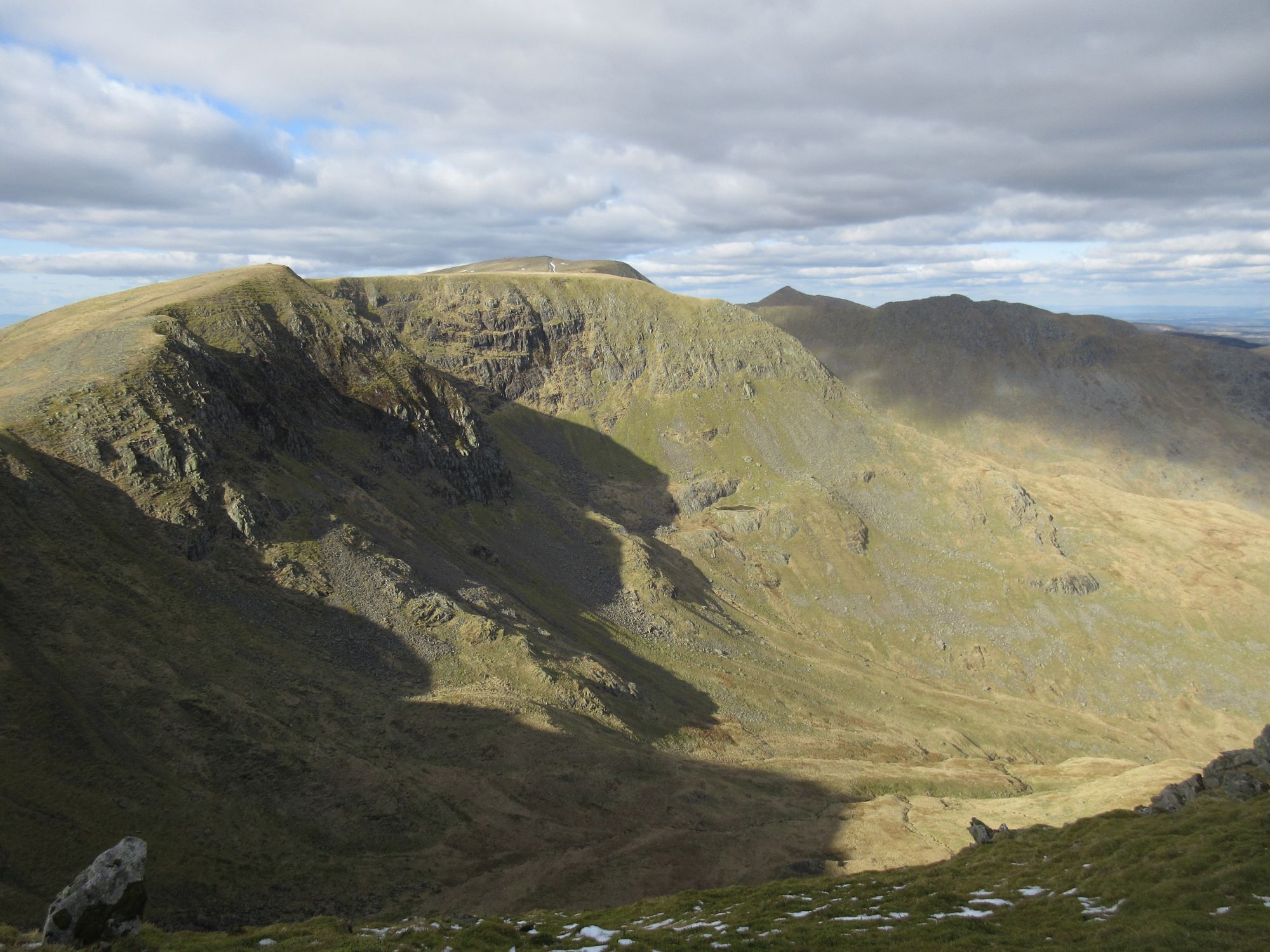
Great views from Ben Vane

Scrambling back down again

By the time we got to the top the cloud had largely lifted and we could at least see the local views and we spent quite some time eating lunch and staring about us.  Our return was back the same way, the downclimbs actually feeling easier than I had anticipated they would be on the way up.  It grew warmer all the way down and we sat reasonably happily outside the Creggans on the way back.

April 23

My preference had been to complete the twin peaks and visit Vorlich, but a large group were heading to the Cobbler so I chose the more social option.  It was properly warm at the bottom with plenty of the gang wearing shorts.  Again we took a steady pace up the zigzags through the woods in order to keep the group together.  The Cobbler looked impressive from the approach, the twisted shapes reminding me of Icelandic hills like Einhryningur.  We circled around the hill towards the bealach between Beinns Narnain and Ime before heading left up engineered steps (some of the way at least).  The wind was a little chilly at this altitude.

Approaching the Cobbler

At the summit col a few of us turned left for the northern peak, with gave terrific views of the rest of the crags and out along the lochs.  Over on the real summit I had a look at the very top but chickened out, though one of our group threaded the needle and scrambled up there.

Summit of the Cobbler

The needle or window is the way to the very top

Show-off

The steadier members of the party returned the same way we has ascended while a few of us took the more direct route.  This was much busier, so we dubbed it the Tiktok Path.  There was even one (English) bloke I spoke to who was only going to walk to the col and not bother with the summit.  Go figure.

Being less tired, the endless zigzags through the woods didn’t feel so bad this day.

April 24

In the evening we had had long discussions about routes on Ben Vorlich.  The standard route was pretty steep and people remembered it as being something of a mess too.  I favoured the route from Ardlui while another argued for the south-east ridge.  In the end we decided to go up the standard route and down the south-east ridge.

Arriving back at Inveruglas, the clag was down so that ruled out ridges on the way up anyway.  The steep path up actually turned out to be less bad than feared.  A lot of it was engineered and it just required a steady plod.  Over 800m we hit the cloud and it got cold in the crosswind.  We made our way along the clear path, careful to check when we had got to the true summit.  There were no views and it was cold (we were basically wearing everything we had brought), so we turned about and headed down the same way we came up.  As we got lower, the cloud started to lift and once we were back on the service road it had turned into a lovely day.  It was early and one of our party wanted to go to Ben Vane, as he had missed out the previous day (he’s an ultrarunner), but he didn’t have his own car and we were all going to the Creggans, so he had to miss out.

Didn't take many pictures on the way up Ben Vorlich

Weather improving on the way down (note how we're dressed)

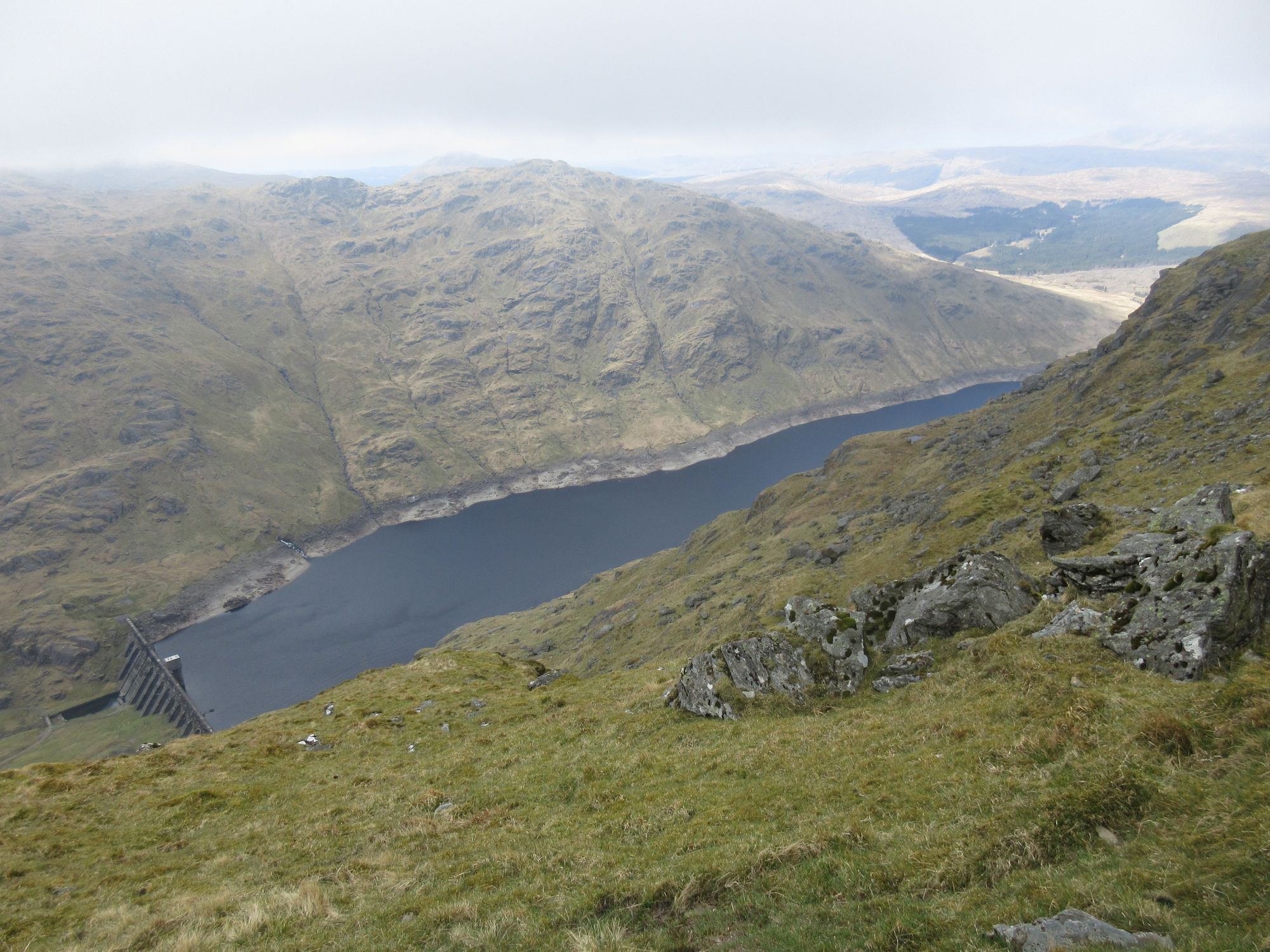
Loch Sloy

Loch Lomond

April 25

My travelling companion and I wanted an early start as there was a rugby fixture to attend that evening, so we bid farewell and hit the road (and ferry).  It had been a great week, blessed with good weather and lovely company.  The walks had been entertaining and had left me with a sense of achievement – four more Munros ticked off – without leaving me completely done in.  Success all round.


Monday, 14 April 2025

Two days in Patterdale April 2025

Day One

To minimise time off, I drove up to the Sykeside campsite in Patterdale after work, meaning that I hit more traffic than I would with my usual early morning starts. All the same, I arrived around 6pm to find the shop still open for check-ins. The weather was bright but windy and I didn't make a great job of pitching my Alpkit Viso 2, but it would do, I reckoned. Dinner was booked for later, as I had wanted to give myself some contingency, but the pub was pretty quiet so I got my table and meal early. Very nice scampi and chips with a couple of pints of Brotherswater IPA, brewed for them by Tirril. The wind was still rattling the tent when I turned in but it became much more still after nightfall.

Alpkit Viso 2 at Sykeside

Day Two
The wind was active again first thing and a few clouds covered the tops, especially further north along the valley. While having breakfast I watched rooks and wagtails pecking through the grass, and stared at the swirls of clouds generated from the airflow over Hartsop Dodd. My route was an extended Deepdale Horseshoe, starting with a climb up Caiston Glen (shirking the breakfast-loosening steep ascent of High Hartsop Dodd) to Scandale Pass. Inattention led me up the eastern side of the beck which was quite a sketchy path but not too bad. It was cool in the shade but warm enough. From the top of the pass I diverted up Little Hart Crag, just because it was there and because it gave great views up the now cloud-free Patterdale.

View up Patterdale from Little Hart Crag

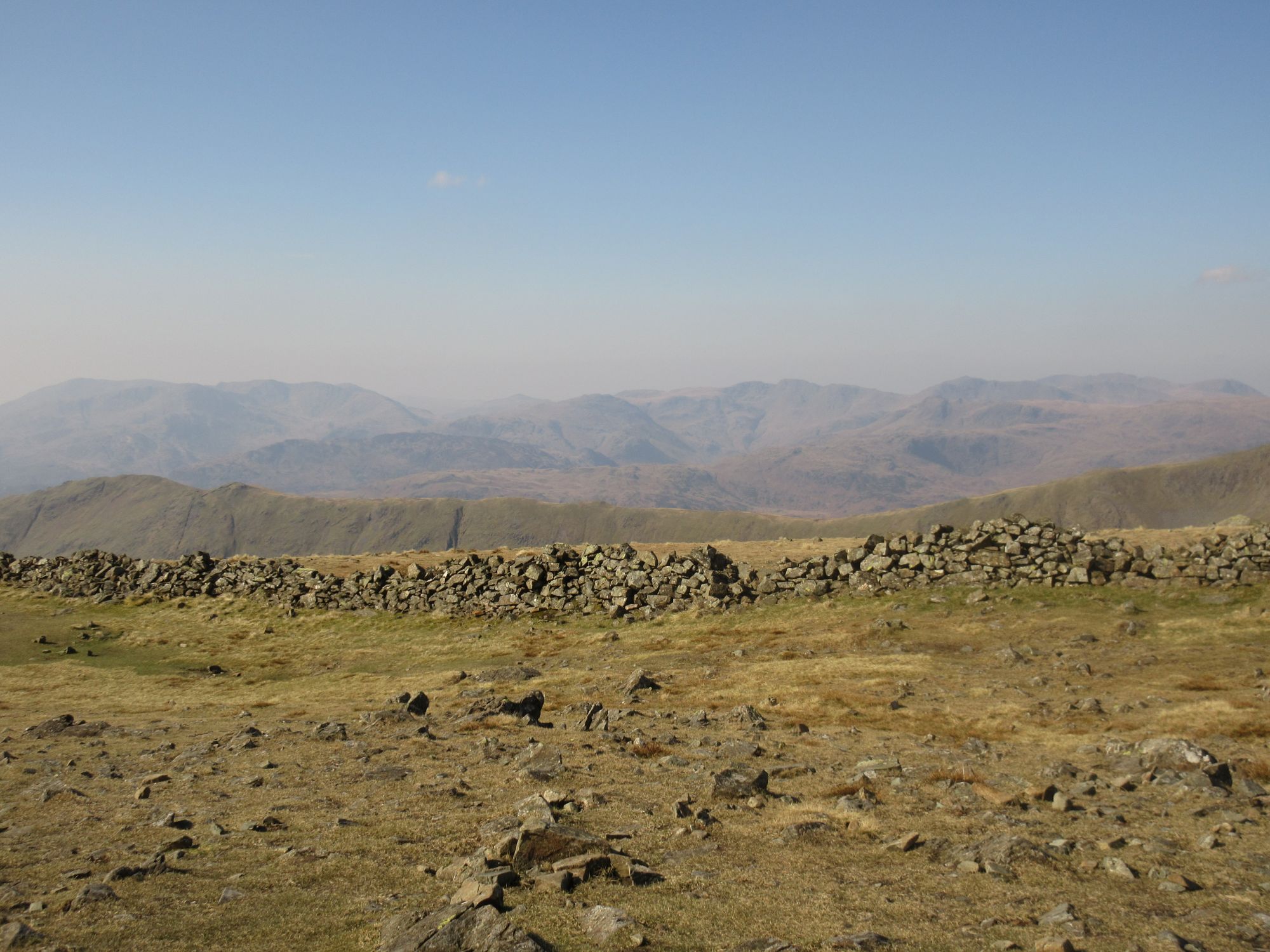
There was a fairly stiff climb up to Bakestones Moss before an easy stroll to Dove Crag, arriving rather quicker than I expected. The wind was properly fierce here and the wall offered little shelter for me to address my need for a snack. The views were a little hazy out to Langdale and Coniston.

Hazy views from Dove Crag

Thankfully the summit of Dove Crag was bulky enough to give me somewhere sheltered to stop and eat before bumping my way over Hart Crag to Fairfield.

Path to Hart Crag

The wind was howling over the bare top of Fairfield, so I wasn't hanging around. Up to this point, about 3 hours in, I had seen around 5 people. From here it was busier, if not exactly thronged with people.

St Sunday Crag from Fairfield

Given the strong breeze I had been concerned about the exposure on the descent over Cofa Pike and had been weighing up my backup plans. As it happened, the wind wasn't too bad, though I did take the leeward bypass path around the very pinnacle of the Pike.

Helvellyn Range from Fairfield
 
On my ascent of St Sunday Crag I found a spot where the wind suddenly vanished, and where there was a rock like a chair. I didn't need a second invitation to sit down for more food. The views over the Helvellyn range and beyond were superb and I took my time regarding it all.

Helvellyn Range from St Sunday Crag

The summit of the hill was too windy for much pause so I carried on to Birks. My intention had been to descend via Arnison Crag but I was marching blithely down, not remembering I had to turn right. When I did look over and realise I was on the wrong ridge, I couldn't be bothered re-ascending - I was getting sick of the battering from the wind - so I just carried on down the rather unpleasantly steep Thornlow End.

Above Patterdale village

A quick pint (or two) in the White Lion - pleasantly done out, good beer, pricey - then a stroll along the valley took me back to the campsite to grab a shower (good facilities) then go for beer and dinner. The steak and ale pie was excellent - only a pastry topper but plenty of meat and they were happy to swap the chips for crushed potatoes instead.

Extended Deepdale Horseshoe

Day Three
It was another windy morning after a mostly calm night. This, combined with the lads in a nearby tent talking a little too loud, woke me at 5:30, though I dozed on until 7:15 before needing to get up.

High Hartsop Dodd in the morning sun

I busied myself packing up until 8 when the shop opened and I could order a sausage bap for breakfast. This, picked up from the pub kitchen, was very good and well-filled. Set me up nicely. Given I wanted a short day and had had enough of the wind, I was going to do a low-level circuit round the base of Place Fell, rather like a Buddhist kora round a sacred mountain, say Mount Kailash. I drove up to Patterdale village, bagging a spot opposite the White Lion, and set out along the Ullswater shore.

Glenridding beyond Ullswater

The bulk of the fell seemed to shelter me from the wind so I quickly dropped layers and enjoyed the calm. Clearly it wasn't windy enough to stop the steamers running.

Ullswater Steamer

I followed the lovely path through woods - to a soundtrack of chiffchaffs, wrens and woodpeckers - along the shore as far as Sandwick before turning up Boredale. The idea was that I would have the easterly breeze mostly at my back, though valleys are tricky things and the wind was rather unruly.

Boredale

I had never walked up this side of Boredale Hause and it proved a very peaceful, quiet place with very few people around. The path climbs steadily at first before getting steeper and steeper over rather loose terrain. The wind really tore through the narrow gap at the top, propelling me forward and out into the open, where I was rewarded with terrific views across the far fells. All that was left was a steep drop down to the car.

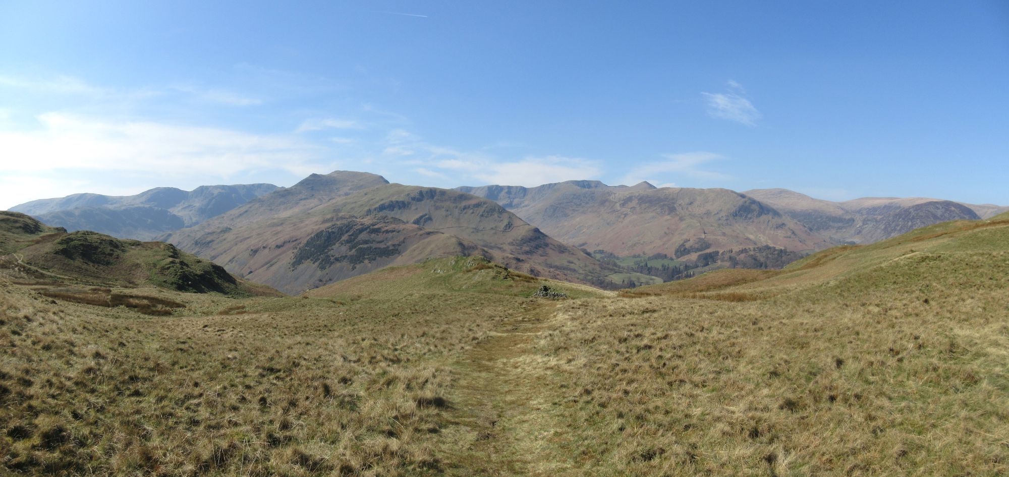
Eastern Fells from Boredale Hause

I had had an excellent couple of days, taking my time and not exhausting myself, privileged to be able to spend some time in such a glorious place.

Place Fell Kora

Wednesday, 19 March 2025

Clough Head to Grasmere 15th March 2025

The weather forecast was too good to resist on Saturday, so I set an early alarm and headed up to Grasmere, arriving at 8am. I had breakfast in the car while the layby filled up and by 8:30 it was full. To start with I took the 555 bus from opposite the Traveller's Rest to north of Dunmail Raise. From Dale Bottom I walked under glorious clear skies towards St John's in the Vale.
Skiddaw and Blencathra
The Vale looked lovely as ever, with Clough Head still shady in the low sun. It felt warmer than the temperature might suggest.
Clough Head beyond St John's in the Vale
On the way up the Old Coach Road I held the gate open for a couple in a Land Rover which headed slowly up before parking at a higher viewpoint. A bloke with a big rucksack was resting nearby. He was camping up on the tops ('Responsibly,' he emphasised). Meanwhile I turned off round Threlkeld Knotts, giving great views of the Coledale Fells.
The Coledale Fells from Threlkeld Knotts
Behind the summit I turned onto the narrow and steep path through Clough Head's Red Screes. Having been walking in just a baselayer, I added another layer to compensate for the loss of the sun.
Red Screes on Clough Head
The final slope was more gentle and dropped me off at the summit, which had a few people coming and going.
Clough Head
That was the major climb out of the way, I just had to follow the ridge south for a few hours. Having said that, the pull up to Great Dodd was big enough.
Great Dodd

Looking towards Keswick
There was a little snow over 750m but nothing much to worry about. It was a little awkward up through the steep rocks onto Raise, which left me blowing a bit.
Raise
Most of the other tops were fairly benign until the slog up Helvellyn Lower Man where I engaged 'crawler gear' to drag myself up.
Helvellyn approaching
All day there had been a steady stream of people without it feeling busy. Helvellyn summit was a different matter with a lot of folk scattered around.  A woman complaining that she hadn't enjoyed 'that' (I'm guessing Striding Edge), lads drinking bottles of beer, a surprising number of Scousers.
Catstye Cam
The views were superb, despite the increase in cloud. To the north was Criffel, to the south Heysham; the Pennines out east (including some distant things beyond Cross Fell) and the full range of the Cumbrian hills west.
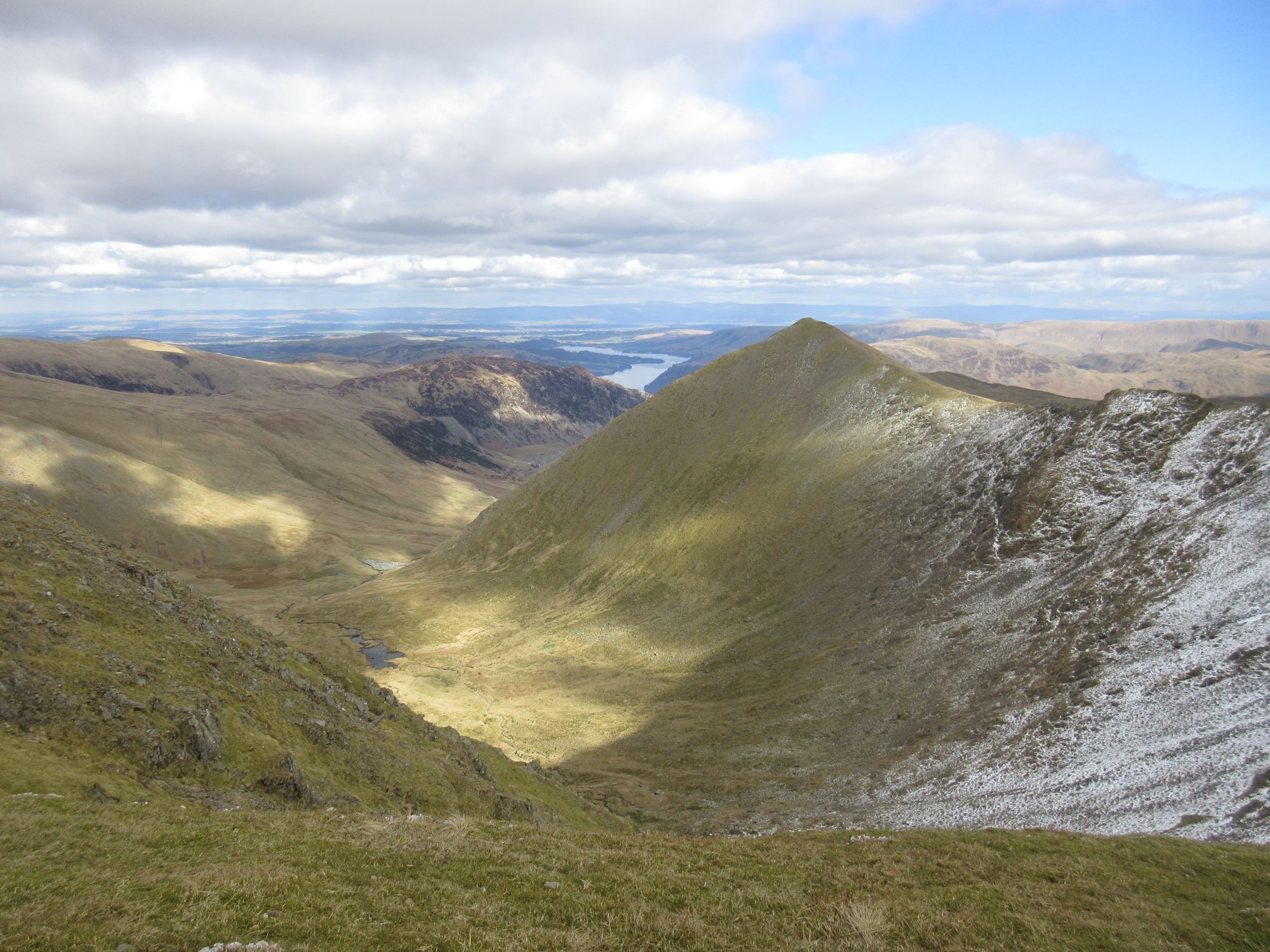
Red Tarn, Striding Edge and Helvellyn's summit
I was getting tired but dragged myself up Nethermost and Dollywaggon Pikes, which were pretty much deserted.
Nethermost Pike from Dollywaggon Pike
The 60 million steps (approx) off Dollywaggon were a real slog and I was glad of walking poles to spare my knees some of the punishment. After a pause for a last snack at an empty Grisedale Hause, there were more steps to stomp down into Great Tongue Gill as Grasmere and the Traveller's beckoned closer.
Helm Crag beyond Great Tongue Gill
It had been a tough walk, 26km with 1500m of ascent, but the weather could hardly have been more perfect. It's great when you can walk in such splendid conditions.