The Dales Way runs for around 130km from Ilkley to Bowness-on-Windermere. Obviously the end section isn't in the Yorkshire Dales, but the creators of the walk thought that finishing at the Crook of Lune, in the middle of nowhere, wasn't very sensible, so they decided to keep on going. I had fancied the idea of the walk for a while and came up with a five day schedule with the assistance of a friend who would transport my luggage and shuffle us between each day's start and end points, and wherever our accommodation was.
Day 1: Ilkley - Burnsall: 22km
It started off wet, got a bit wetter, then settled into steady drizzle later. Whatever the sales blurb says, I have never found anything 'waterproof' that can hold off that amount of water. After a couple of hours, I was getting wet. Unfortunately, that encouraged me to race along somewhat, meaning I didn't give myself enough time to admire the lovely scenery along the Wharfe, beautiful despite the weather. I was also a little more tired by the end of the day than was planned, given my schedule.
Plaque on a stone bench at the start of the walk in Ilkley.
I didn't risk the stepping stones at Bolton Priory, seeing as a few of them were underwater. Groups of schoolchildren were sheltering under the trees nearby.
The Strid, a narrow gorge on the River Wharfe. Given how dry it had been in all the weeks leading up to my walk (yeah, cheers), it could have been a lot less dramatic here.
There were lots of bridges and lots of crossings and re-crossings of the Wharfe. After this point I put my camera away as it was getting too wet, as you can tell from the spots on the lens. It was a great relief to arrive, dripping, a little out of sorts, at the Red Lion in Burnsall.
Day 2: Burnsall - Hubberholme: 25km
After an excellent overnight stay at the Forester's Arms in Grassington, the first of our two nights there, I was dropped back at Burnsall in much finer weather, allowing more time for the views. This is Loup Scar.
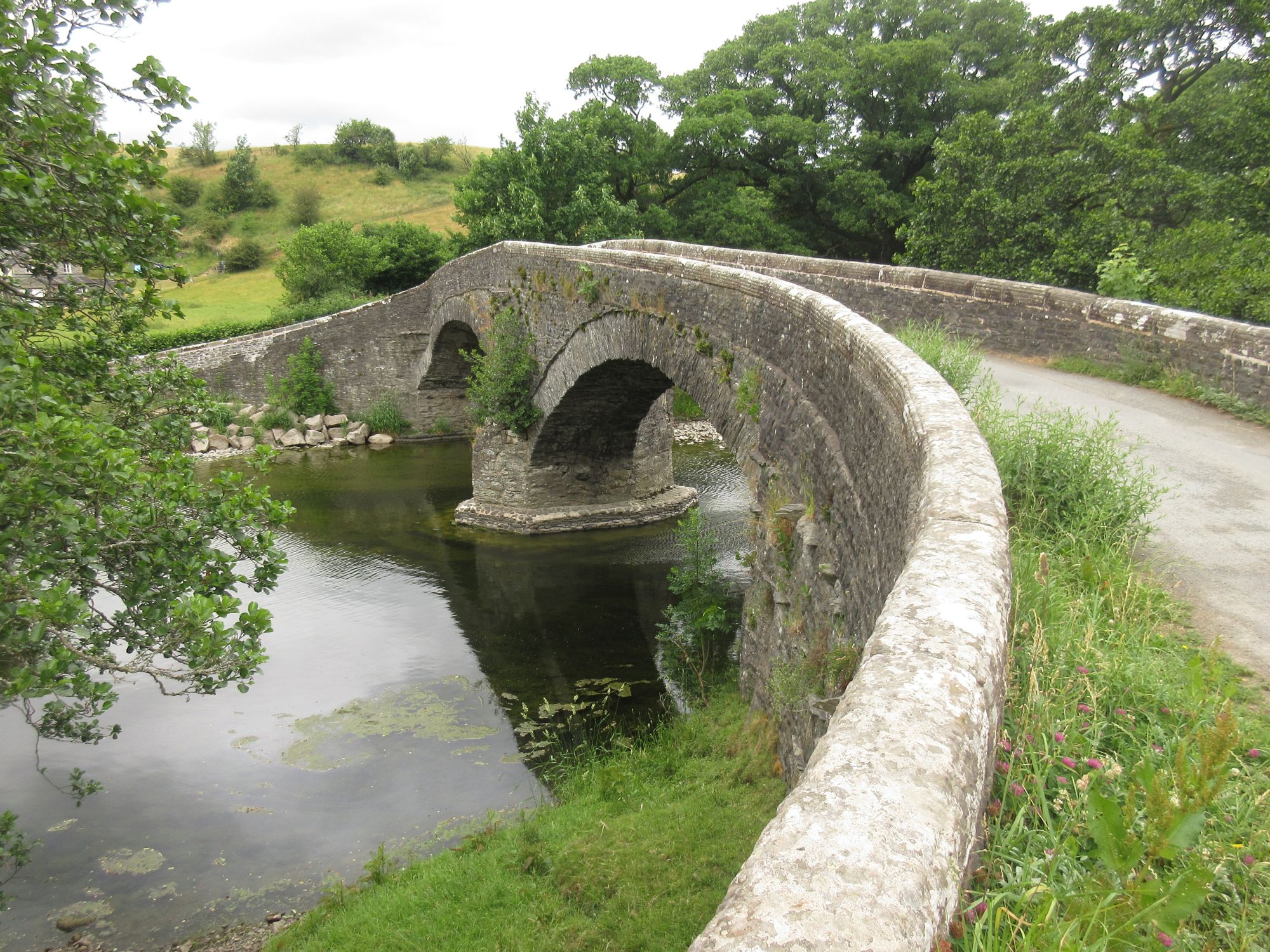
As well as bridges, this walk featured a lot of stepping stones. Hebden's narrow bridge offers an alternative to these but I used the steps.
These ones lead to Linton Church, a slight diversion off the path.
Linton Falls.
After passing back through Grassington, the route climbs onto the edge of the hills, following limestone scars to parallel the river's course, here at Conistone Dib. It was pleasant, easy walking up there, with few people around.
Conistone Pie, a rotund outcrop of stone, is too much of a temptation not to climb. The views down Littondale and Upper Wharfedale were excellent.
After Kettlewell, where I passed a couple chatting to their two alpacas in the front garden, the path returned to the river. I pushed on past Starbotton and Buckden to arrive, somewhat weary-legged in the heat, at the George, a popular place for Dales Wayers to stay, it seemed, though we were back at Grassington after a couple of pints.
Day 3: Hubberholme - Dent: 34km
I had given myself a bit of a challenge on this walk. It's mostly pretty flat, so I thought that I could get away with some long days. Flat or not, this was tough going. The scenery of the higher reaches of the Wharfe near Beckermonds is rather nice though. It felt like being in the heart of the Dales. Again, it is easy valley walking.
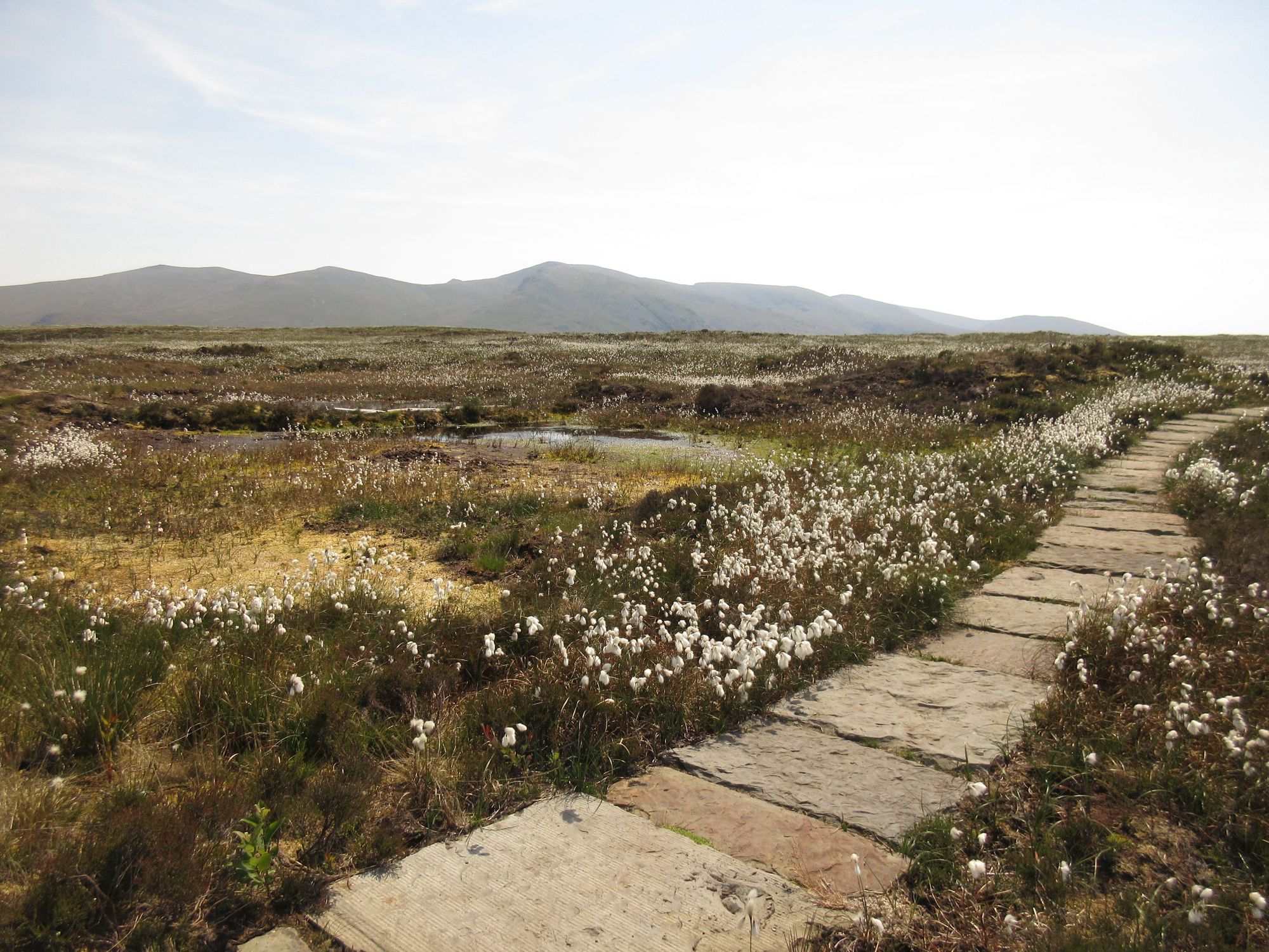
I was following the 'watershed alternative' route, so at Cam Houses, I turned right and switched onto the Ribble Way to tmke my way across the tops. It was, for me, the best section, with straightforward walking on the Pennine Bridleway and with huge views to all kinds of hills whose names I didn't know (except, obviously, for the Yorkshire Three Peaks). Once again, out of the valleys, it was very quiet.
Climbing Great Knoutberry Hill is optional and, perhaps foolishly, I decided to add this too. In retrospect I should have dropped down Arten Gill to give myself an easier day but a certain kind of stubbornness took over and I hauled myself up to the highest point of the walk at 672m.
After a lot of road walking from Dent Station to Lea Yeat, I had a lot of valley walking through Dentdale before arriving at the Sun Inn, our rooms for the night. By this point I was footsore and something like a zombie having pushed along overgrown paths and stumbling on hidden roots and rocks. A few pints and a meal at the George and Dragon (just behind me when I took this picture; the Sun doesn't do food) helped make things better. It had been a hot day and I had drunk pretty much all my 2.5l of water on the way.
Day 4: Dent - Burneside: 34km
Obviously two long days back to back is madness, but I was locked into my schedule and determined to do it. Each morning I set off feeling pretty good and then got wearier and slower as the day progressed. There was a slight drizzle at first, not warranting a waterproof, before the day settled into a blanket of grey warmth. Dentdale was green and lush.
After a slight climb, the path drops towards Sedbergh and the Howgill Fells before swinging west again to reach the Lune Valley. The Howgills are in view all along this stretch as you head north. It was a beautiful, peaceful area, with the river running gently over rocks.
Crook of Lune Bridge.
Lowgill Viaduct. The end of the Dales with the M6 roaring in the background. After this was a lot of dispiriting wandering through farmland, switching direction, missing turns (the signage was poor), and watching the rain arrive over the Sleddale fells before falling on me for hours. I stumbled, dripping once more into the Jolly Anglers in Burneside, glad to take the weight off my aching feet.
Day 5: Burneside - Bowness: 16km
We stayed in a cottage in Kendal and had a great night - dinner at Ye Old Fleece and pints at the Indie Craft Bar. The relief of having a short day to finish with put me in a decent mood. First there was a walk along the River Kent to Staveley, then some low, rolling countryside, punctuated with rocky lumps and bumps. It gave the landscape a proper Cumbrian feel to it, and I enjoyed the familiarity of that.
It was dry, after a brief shower in the morning, but with a chilly wind higher up. There were no difficulties with the terrain or the route-finding today, and in no time at all, it seemed, I arrived at Ilkley's twin bench, just on the outskirts of Bowness. All that was left was to wander into horribly busy Bowness, meet my friend at Boater's Bar then head back to Kendal for celebratory drinks.
The walk was a bit of a lesson to me to think more carefully about my abilities. I've done lots of multiday walking and long distance routes but never anything with such long days back to back. I had rather overestimated what I was capable of, or rather, because I suffered no real problem (tendons, muscles, blisters), I had overestimated what I could do and still enjoy. Long days are fine for me as one-offs, but it would seem better to take my time over these multiday routes and spend more time enjoying them, not enduring them.
I've walked in the Dales lots of times in the past and done all the obvious hills. This walk gave me a different perspective, readjusted my viewpoint and gave me ideas for visiting some of the more out-of-the-way areas. There's a lot of them and I've been inspired to go and explore some more. Perhaps that's the point.