Emstrur – Langidalur: 16.5km
Despite the usual cacophony of snoring, it was probably my best night’s sleep. Perhaps the tiredness was just catching up with me. Everyone started to stutter into life around 6:30 but it was awkward to manoeuvre round the hut because of the lack of space, you were always in someone’s way or they were in yours. Arnab cooked up a big pot of porridge for all 20 of us and somehow we contrived to eat that, wash up, make packed lunches and pack our bags without fisticuffs. Jæja, we were ready to go for 8.

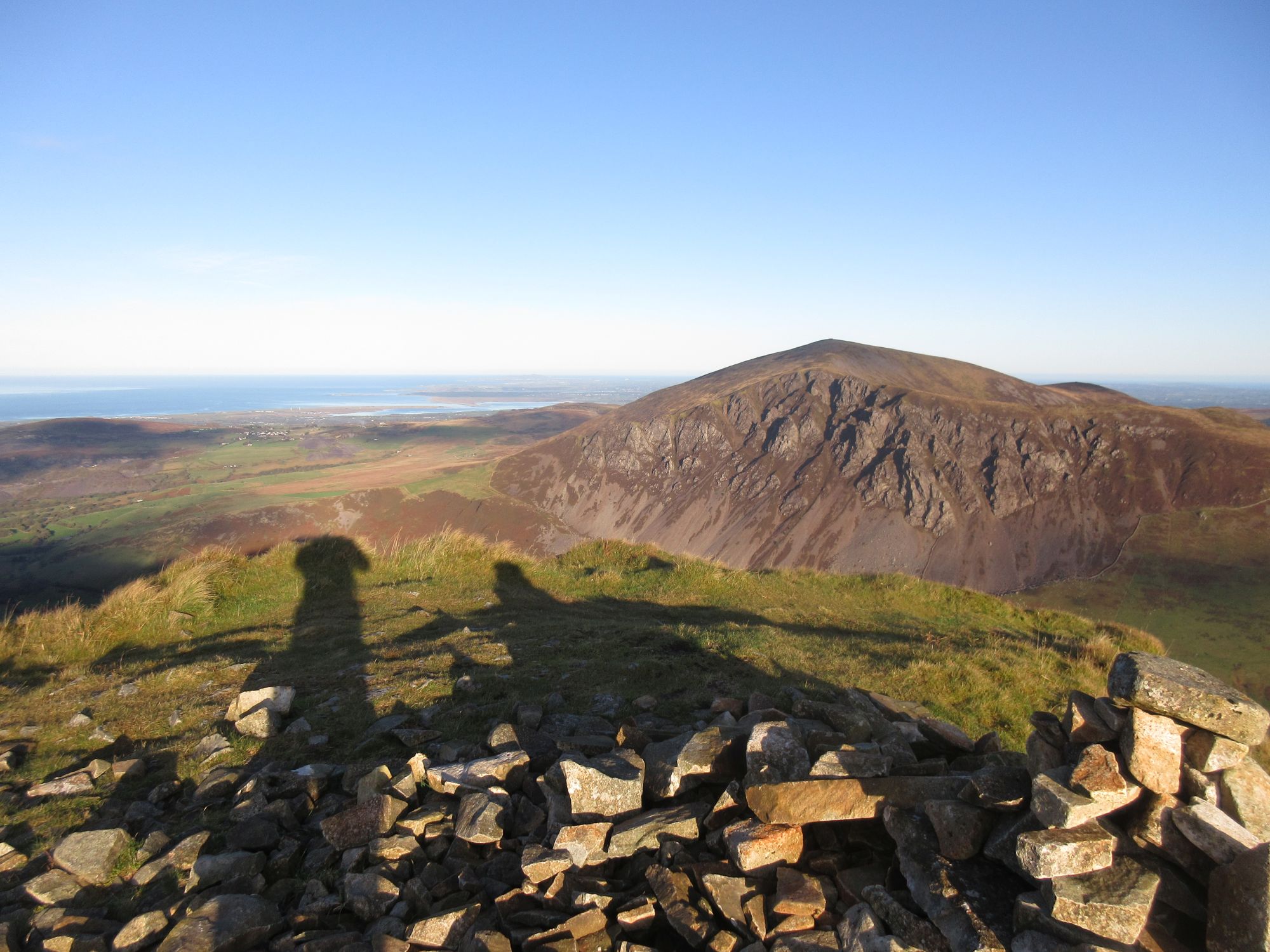
It was a sunny but cloudy day with a stunning view over the hills to the glacier. The path set out over more gritty ash and moss, dipping up and down with Markarfljótsgljúfur keeping us company on our right. The wind battered us as we pushed on finally to emerge onto a lava field of broken slabs of rock. Einhryningur, the Unicorn Mountain or, more recently and anachronistically, the Rhino Mountain, appeared on the far side of the canyon and watched over us for a while. HD set another furious pace through the rocks and distant basalt cliffs. Anyone stopping for a photograph was quickly out the back of the peloton. Once more I tried to get to grips with the landscape, a vast, textured nothingness, somewhere between presence and absence. Later, when I got home, I found a number of out-of-focus pictures from both of my cameras, not taken that way deliberately and blurry in spite of their autofocus facilities. It was as if the cameras, like me, couldn’t grasp what it was they were pointing at, the lens as dazzled as the eye by the geological wildness.


Finally we dropped down a low cliff and paused for a moment. Ahead of us was the start of the forestry area. We also encountered sheep for the first time since Landmannalaugar, which seemed to entertain the Americans. More steep descending took us to across the Ljósá, where there was, thankfully, a bridge and we stopped amongst the birch trees for some food. It was a botanist’s dream with bilberries, crowberries, juniper, wild thyme, lady’s bedstraw, lupins, mushrooms, fungi and many things I couldn’t hope to name. The bilberries, on rather stunted plants, were a nice treat.

A track took us down to our final river crossing at the Þrongá where we found a couple of girls not wearing any trousers. They informed us that the river was over knee height in places so we followed their lead and disrobed. HD took his time looking where to cross and said that it had changed channels significantly since he last passed that way less than two weeks previously. In the end he forged his way through with us, carefully, in his wake. I buddied up with Sophie again and we clung on to each other through some shallow and some heart-stoppingly cold channels. The final channel was the deepest and the strongest flow. My trekking poles were a liability, being pushed by the current, so I held them out of the water. Despite trying to follow HD’s advice, I found myself putting a foot in a hole and stumbling, saved by my partner. Most of us tried to hurry out of the water, against the advice, and Nadine slipped onto one knee at the final hurdle. All the same, we came through pretty much unscathed, sitting around cleaning the grit off our feet in a whirl of relieved chatter.


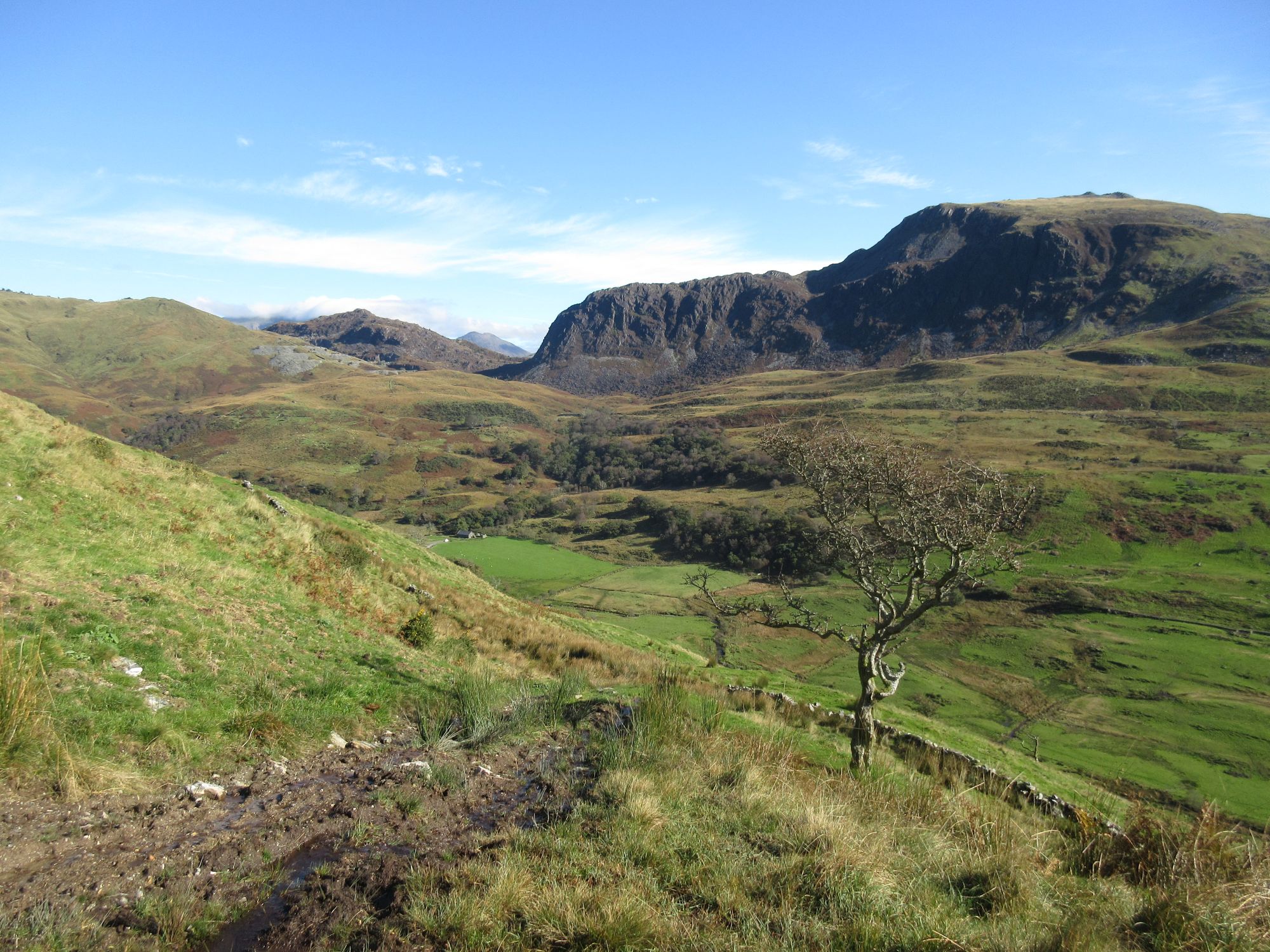
There were more ups and downs through the trees until we finally emerged with a view of the great valley of Þórsmörk, surrounded by spikey peaks and the looming, cloudy presence of Eyjafjallajökull. At the final sign for the Laugavegur Trail, we exchanged high-fives and hugs, congratulating ourselves on making it. All that was left was a stroll down to the Langidalur hut for coffee, biscuits and Nadine’s celebratory chocolates. Before long it was time for those on the shorter trip to load up the bus and return to Reykjavík. David set up a WhatsApp group, getting confused about the non-US numbers. ‘What’s the +44 all about? My phone keypad doesn’t have a plus.’ We explained how international dialling worked. Even though I had struggled at times with the lack of solitude within the busy group, it felt emotional to be saying goodbye to everyone after all we had been through. Nadine and I, the only two remaining, stood on the pebbly beach until the bus splashed off through the many channels of the Krossá. Jæja.
HD now explained the problem with our planned onward trek to Fimmvörðuháls. The route lay the other side of the river and the Krossá was uncrossable on foot, only via a vehicle. The flow was too strong and too deep, there were too many channels for the mobile bridges to cover and the channels changed too frequently for the warden to keep up with. Besides, the head warden, Simon, was overworked as his fellow wardens were a 67-year-old woman and a tiny Costa Rican girl, so the heavy-lifting was all down to him. In fact, he was out in a tractor shovelling stones for the vehicle route and we could also hear a big road-mending machine away on the far side. Instead of the crossing, HD would come up with a route on the near side of the river.
Our room was upstairs and, bliss, it was just the two of us in it, so we could spread out and enjoy some peace. I called by the wardens’ hut to get a shower voucher and was led to the shop by the 67-year-old, a laconically droll Icelander. Pointing at the beers she said, ‘This one is beer [Boli], this one is beer [Gull], and this one is wannabe beer [Pilsner at 2.25%].’ The shower was very hot, eventually. It used quite a few of my voucher’s allocated 5 minutes just warming up.
Back at the hut an Irish bloke called David was greeted warmly by HD. He also worked for Artic Adventures and had five clients with him – a German father and son, an Australian couple and a Maltese bloke – who hadn’t been able to cross the river. The Langidalur Hut was posh enough to have a large dining area and a few sofas to lounge one. So lounge we did, sitting around chatting. We also teamed up for dinner, which was a huge and delicious pan of spaghetti bolognese. I had about three helpings but there was still enough to feed other stragglers, starving from their boil-in-the-bag meals. One of them was another Australian who had been waiting to cross the river for two days. She was giving up and getting the evening bus out. Coincidentally she worked in the same building as Nadine in Geneva, so they had plenty to chat about.
Just as we started the meal, Simon the warden came in, saying he was going out to look for ‘an Asian man’ who had been reported missing on the trail. HD shoved two big scoops of spag bol down, took a slurp of beer, then headed out with him. David prowled restlessly for a while before also going out later. We were left to nurse our concerns. After more chatting and a bit of reading, I turned in at 9pm. Mistakenly I had laid my bed out along a mattress with my head under the low eaves. I bumped it about three times just lying down and regretted not following Nadine’s example and lying right across all four mattresses. It was a bit late for me to rearrange as she was already asleep on the other side of the room. Just after 10pm, HD poked his head through the door to say everything was ok, the lost person had been found. It was good to hear.
The full story was that the ‘Asian’ man’s wife had been taken ill and had to be transported to the end of the trail while he walked on, though he was rather at the end of his tether as our group passed him (I don’t remember that bit). HD and Simon had set off back up the trail, asking people about him. It was clear he wasn’t on the trail so they went off to Húsadalur and the Volcano Huts (commercial accommodation about 2km away). Apparently Simon burst into the restaurant and announced, ‘Has anyone seen an Asian man?’ The confusion was slowly resolved and several people came forward to say the man had already left on a bus. The intrepid searchers grabbed themselves a beer, which is how David found them. And, he said, rescued them. Jæja.