1st August: Gummer’s How – Whitbarrow Scar – Cartmel Fell – Staveley Fell: 22km
Although it was well gone 9am, there was no one else in the Gummer’s How car park. Some cloud was covering the high tops and a little whisp was playing with the summit of Gummer’s How. I trotted off on a well-made path, passing some lethargic cattle, and making the summit in around 20 minutes, despite a little unexpected scrambling. The cloud hadn’t entirely gone and the distant views were somewhat hazy. On the way down I passed a group of four people and two spaniels. It looked as though they had parked on the road rather than in the empty car park, oddly.
 |
| Gummer's How |
 |
| Newby Bridge from Gummer's How |
 |
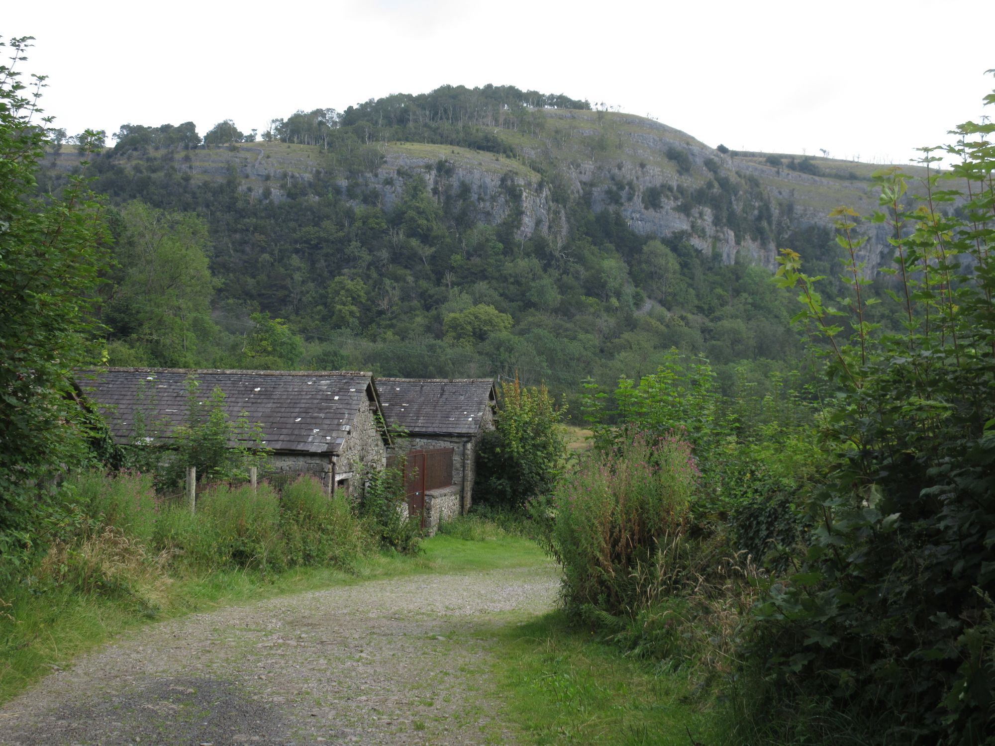
| By Sow How Farm |
 |
| By Sow How Farm |
 |
| Heron by the River Winster |
Tarmac’ed Sow How Lane became an unsurfaced invitation to the open countryside beyond the eponymous farm and it led on very pleasantly through woodland and fields, where grass and bracken were wet from the early rain I had left behind, to Thorphinsty Hall and over the River Winster. Ahead loomed Whitbarrow Scar, looking squat and formidable with no obvious way up. The route went by the grand Witherslack Hall (now Oversands School) and crossed over the football field, which sat right at the bottom of the limestone cliff. This developed into a line of attack up the face, steep and slippery but not too unpleasant. Beyond the trees the views opened up to fractured pale limestone covered in a wonderful array of wildflowers: scabious, harebells, hawkweed, tormentil, stitchwort, wild thyme, heather. The trees were wind-bent away from the edge of the scar. Around my feet there was juniper everywhere – I’ve never seen such profusion
 |
| Approaching Whitbarrow Scar |
 |
| Whitbarrow Scar |
.
 |
| Whitbarrow Scar |
 |
| Whitbarrow Scar |
 |
| Whitbarrow Scar |
Walking across the top was an absolute delight, between clints and grikes, amongst the scattered trees, with sunny views over the Winster and Lyth valleys. Even the distant high fells were clearing up. Eventually I dropped down by Bell Rake, amongst a great number of yew trees, and speculatively took a track, not a PROW, to Pool Bank, thus saving myself some distance and road-walking. From there I cut across to Cartmel Fell and onto Raven’s Barrow, where I saw my first walkers since Gummer’s How 3.5hrs earlier. I didn’t hang around the summit as it appeared to be Flying Ant Day hereabouts, instead pushing on across the attractive farmland back to Sow How.
 |
| Cartmel Fell |
 |
| Cartmel Fell |
 |
| Windermere from Staveley Fell |
As I was in good time, and felt well, I decided to add Staveley Fell to the route as an out-and-back via the forestry tracks, again not marked as a PROW. While passing through the woods the peace was shattered by two F16s (or similar) flying low, directly over my head. They made two more passes before leaving me alone. The views from the top of the fell were superb in the sunshine. I had a quick pint at the Mason’s Arms then drove round to Great Langdale campsite to meet everyone else.
 |
| Home for the weekend |
2nd August: Walna Scar Road – Dow Crag – Coniston Old Man – Great Carrs – Wet Side Edge – Blea Tarn: 20km
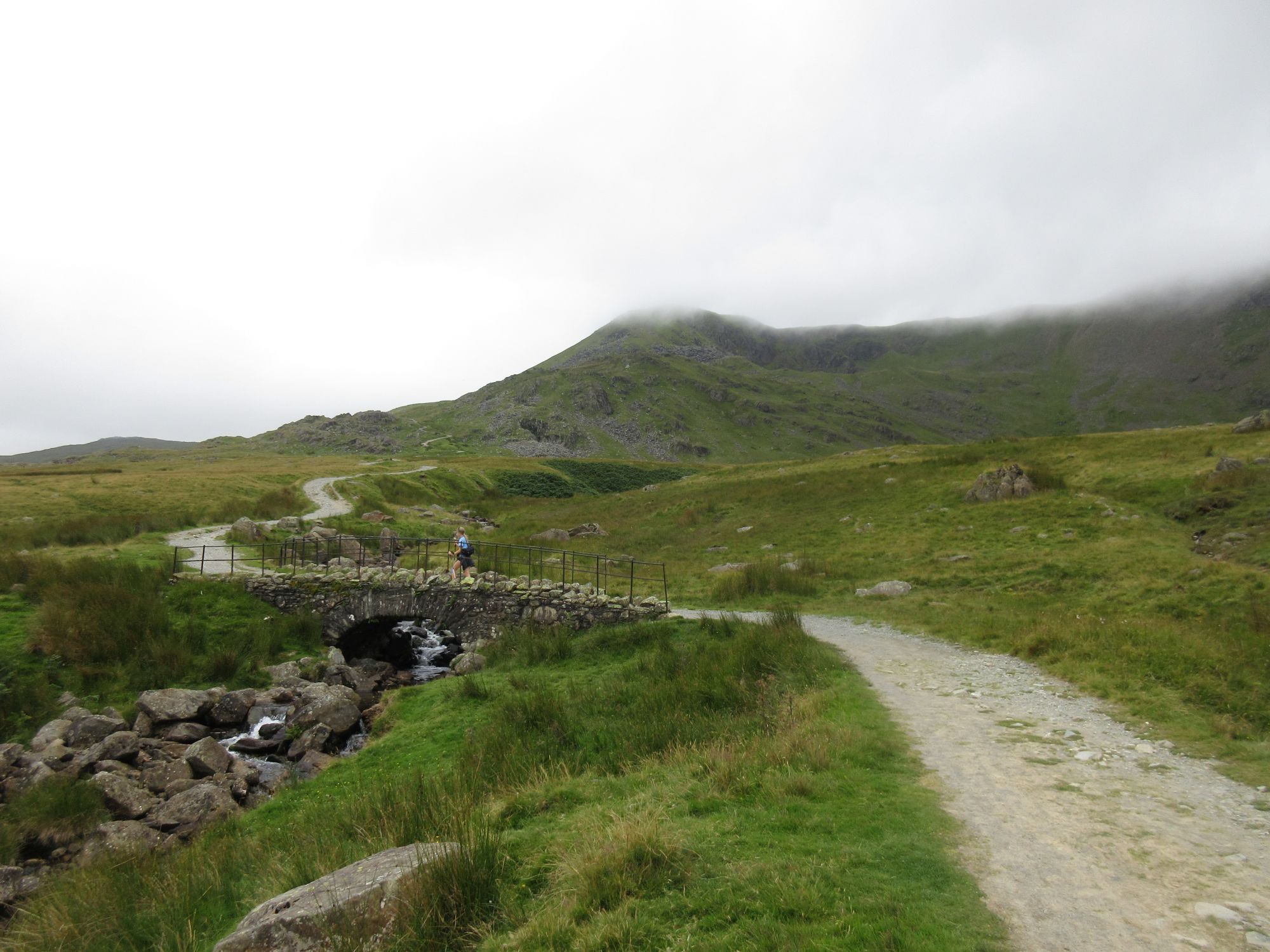
One of our fellow campers, John, offered to give us a lift to Coniston for a walk. He had a people carrier and there were six of us, plus Amber the dog, so it worked out very nicely. He was even happy to drive up to the Walna Scar car park (properly surfaced now) to save us some ascent. The clouds were down but we were hoping they would lift at least for a while before the rain moved in later on in the day.
 |
| Climbing Walna Scar Road |
Immy, the teenager, bounded off ahead while the rest of us plodded along more sedately. As we turned off Walna Scar to Brown Pike, it was clear the clag was down for good. We disappeared into it on Dow Crag and stayed there, except for a few dips along the way. We did get a view of the crags from Goat’s Hawse. The wind was strong too, meaning we had to choose our stopping places carefully to keep out of it. Maybe the shorts were a bit optimistic. There were no views from the Old Man and lots of people around, so we took a quick selfie and moved swiftly on.
 |
| Levers Water |
 |
| Greenburn from Great Carrs |
It was actually a pleasant walk along the ridge, which would have been nicer with some views, like the fleeting snapshot of Wetherlam we had. Just north of Great Carrs we found some shelter which had decent views down Greenburn to accompany our second lunch. There was a discussion about our route next. Matt doesn’t like the descent from Red Tarn, so we looked at going via Blea Tarn. I didn’t fancy the road walking, so suggested Wet Side Edge. And that’s the way we went. To save some time we aimed for the path to Hollin Crag. On the OS map it’s a black dotted line, in real life it’s a massive patch of bracken. We picked our way round and about it in a winding line. Finding ourselves at the top of a rocky gully, we edged round one side before switching back to the other. Beyond this we briefly found a path, or sheep trod, and then the terrain eased up on our approach to the River Brathay. Thankfully the dry weather meant it was an easy crossing, as long as you avoided the slimy rocks. All that was left was the final drag over by the tarn. The rain that had threatened came a little more strongly, though thankfully we were sheltered some of the way by the trees, and it only really came down hard once we were in the bar of the Old Dungeon Ghyll, when it didn’t matter so much.
 |
| Not the greatest descent from Wet Side Edge |
 |
| Crossing the River Brathay |
 |
| Langdale Pikes the far side of Blea Tarn |
3rd August: Lingmoor Fell – Elterwater – Chapel Stile – Lanty Slee’s: 12km
It’s become a tradition to do the Langdale Pub Crawl but this year the others were tweaking it a little to make it more accessible to the non-walkers, missing out Little Langdale. I wanted a bit more of a walk so took myself up Side Pike, having never actually been to the very top, and Lingmoor Fell. In both cases my navigation was a little wonky. I ended up down-climbing from Side Pike, though not in any particularly sketchy way, and for some reason turned off the main ridge of Lingmoor after the summit.
 |
| Langdale Pikes from Side Pike |
The accidental benefit of the latter’s boggy path was that I was treated to an amazing number of sundews. There was a lot of butterwort too, though the flowers had died off. I was surprised at how the bog asphodels were dying back too, having seen such a colourful abundance of them just over a week before. On the way back down the valley, I unexpectedly bumped into one of my cousins and his family, who were staying in Elterwater and doing the pub crawl in the opposite direction. Small world.
 |
| Insectivorous butterwort |


No comments:
Post a Comment