Saturday, 29 June 2024

Yorkshire Heritage Way: June 2024

Day 1: Bradford to Burley-in-Wharfedale: 22.8km

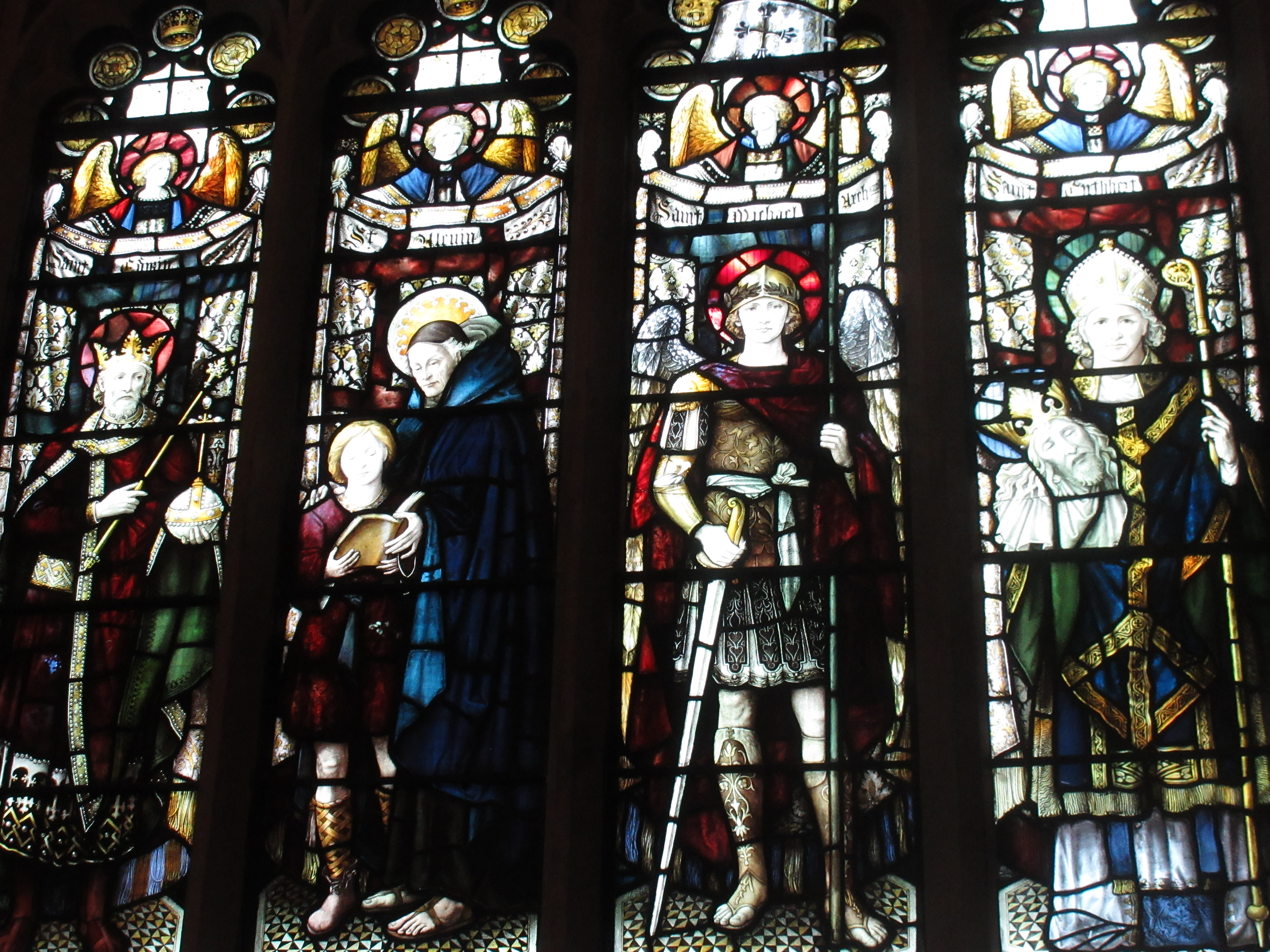
The official start of the route is Bradford Cathedral but as I was taking the train over from Manchester, I started from Bradford Interchange.  After a quick look at the city hall (which has an OS benchmark flush bracket in the wall), I made my way to the cathedral.  From the outside it’s quite nondescript but I was pleasantly surprised by the interior where there is a splendid wooden-beamed ceiling with carved angels, and stained glass designed by William Morris & Co.

Bradford City Hall
Bradford Cathedral

William Morris & Co stained glass in Bradford Cathedral

The weather was fine and mild as I walked some roads before ducking off through a confused series of ginnels, variously overgrown or lined with fly-tipped rubbish.  There was a brief section of open parkland before I ended up thrashing through nettles, thistles and brambles – my GPS assuring me I was exactly on the path – and cursing having set out on the route.

It was a great relief to come to the Leeds – Liverpool Canal for a gentle stroll to Saltaire.  Being close to the SALT Brewery, I couldn’t resist a quick diversion to the taproom.  The terraced streets of Saltaire, commissioned by Sir Titus Salt, were being used for filming a period drama and I spotted Alan Bennett sitting with the production crew.  Something to look out for on the telly.

Shipley Wharfe
Back on course, following the River Aire briefly, a short, sharp rain shower came down.  It was just long enough to warrant putting on my jacket but the climb up to Shipley Glen had me removing it again.  The wooded glen was attractive with the path running above the river.  I brushed passed a sign indicating the path was closed and found a short section where it was slightly washed away.  Having struggled through the weeds earlier, I wasn’t daunted by this challenge and skipped around it.
River Aire

After that was a series of farm tracks and fields that had me checking the route frequently (I saw my first YHW waymarker after 16km) until coming to the open countryside of Hawksworth Moor on the shoulder of Ilkley Moor.  As I was feeling the effort from carrying a heavy, multiday bag, I chose what I thought was the simplest route without checking the ‘official’ one and went via Hag Farm and Hag Farm Road into Burley, missing out the Hermit (apparently the late Richard Whiteley’s local).  Along here there were more people out than I had seen since leaving Shipley, including kids coming home from school.

A rarely-spotted waymarker

The walk through Burley seemed something of a drag until finally I got to the Red Lion to meet Jill who was giving me a lift.  After a quick pint we drove up to the Hermit, which was rather nicer than the Lion, before heading to friends in nearby Menston for the night (yummy fish and chips from the Wetherby Whaler for tea).

Day 2: Burley-in-Wharfedale to Pateley Bridge: 29.8km

Forecasts suggested it was going to be a wet afternoon so I kept the waterproofs with me while dropping as much else with Jill who I would see later in the day.  It was a relief to have a lighter bag on my back.

The route crosses Burley stepping stones but the flood watch website gave a river level reading that was higher than the crucial 0.17m (0.24m, I think) which would allow safe passage.  The route was created by Burley Ramblers as a means of raising money for a bridge to be built alongside the stepping stones, a cause I was fully in support of that morning.

Fast-running River Wharfe at Ilkley

Rather than the official diversion along the A65, I chose a countryside route to Ilkley, which was really nice in the bright morning sun.  There was another clomp through town to Denton Bridge, noting the rushing River Wharfe, and an unpleasant walk along the busy Denton Road.  This got better as I climbed through Denton and up into farmland, meeting some friendly, if noisy, pigs.  Finally I was out on the moors again where my spirits always lift up, even if my feet were sinking into bogs and I was being harassed constantly by angry curlews.

Ivy House on Denton Moor
Again I ducked off the official route to take a more obvious line via Timble Grange before diving into a faint path through Beecroft Plantation.  It suddenly dawned on my that the whole route was designed to use rarely frequented paths rather than the obvious ones.  This boggy trot was no exception.  Beyond the wood I reached the excellently named Blubberhouses.  The path onwards up the River Washburn required me to hop over Armco barriers either side of the road, disconcertingly.  At the entrance to the path a notice warned that the route was blocked higher up for forestry operations but the diversion looked fine.

Blubberhouses Church
The valley, once the traffic noise had faded away, was delightful.  It was shady and secluded with a rocky bank on the far side.  A heron flew off at my approach and repeated this procedure a couple of times before leaving the wood for the fields on the far side.  Blackbirds and wrens flitted off in surprise at my presence, and grey wagtails chased each other over the water.

River Washburn
It was nearly time for something to eat but the first bench I came to was occupied by the first people I had seen since Beercroft Plantation.  Luckily there was another bench just before the diversion.  Talking of which, I had to wander around a bit to find the start of the path before just taking a chance and marching up the hillside, spotting what could be a stile somewhere above me.  Once over the ditch I could see the line climbing steeply out of the valley through felled trees towards what did indeed turn out to be a stile.  It climbed some more until reaching the road.

It was hot now so I took off a layer.  The immediate effect of this was for the wind to pick up but I battled on all the same.  The climb up past Thruscross Reservoir along the road was a bit of a drag until I could cut across moorland.  Here I was mobbed by curlews again and a particularly aggrieved lapwing who swooped within a couple of metres of me.  I made my apologies and kept going as best I could.

Angry lapwing
There was more sketchy waymarking and a series of farms and hamlets, a number with lovely displays of flowers outside.  After Heyshaw I hit a good track and, feeling I had been slow and dawdling for most of the day, got into a good stride.  The skies were darkening to the west, well after the forecast arrival of rain, although it felt like an easterly breeze.  Resisting the temptation for quick diversion for a trigpoint on High Crag, thanks to the threat of rain and the distance already covered, I pressed on, only for the paths to get confusing again.  One way or another I arrived at Glasshouses and headed, off-route, to Pateley Bridge.

This was a quick, level stomp by the River Nidd with the odd muddy section.  Just before the village, almost at the old station, the rain made its late appearance and it bucketed down.  Despite being so close, I had to stop for a jacket and arrived at the Crown dripping.  Thankfully it was a welcoming place with excellent hot showers, filling meals and a selection of decent beers.  A good finish to the day.


Day 3: Pateley Bridge to Ripon: 26.2km

The ‘medium’ breakfast was perhaps ambitious, but at least I hadn’t gone for the ‘large’.  It was sufficient enough that I didn’t feel like eating anything again until four hours later, despite my usual morning urge to snack.

River Nidd

To begin with I retraced my route to Glasshouses and then carried on along the river to Smelthouses.  I could see and hear tree surgeons at work up ahead and of course they were right on my path.  After a quick shout they gave me permission to pass through into the Fell Beck valley.  This was another delightful little wooded glen with a peaty stream chuckling over rocks below.  A sign warned that because of ‘old age and climate change’ the owners had cancelled public liability insurance for the path and I entered at my own risk.  Bear Grylls has nothing on me and I plunged on, clearly living to tell my tale on the other side.  I’m not sure what the problem was.

Fell Beck

The path finally started to climb up towards Brimham Rocks, making my knees protest for a while.  It was only a short ascent to the top where I had a wander round the various gritstone formations.  They reminded me somewhat of the Peak District’s edges, or the lumps you get in the Cairngorms (Barns of Bynack, say).  When I was a kid, we had travelled over from York for a day out a couple of times, but I haven’t really been back since.  There were a few people around so I didn’t stay long.

Brimham Rocks
A twisting, turning course over heather moors (with the flowers just coming out), farmland populated by cattle (very uneven and dungy) and occasional woodland eventually took me to Sawley.  It seemed rude not to stop at the Sawley Arms for a quick refresher, given the sunshine and the building heat, before cracking on.  Woodland took me down to the River Skell, which leads to Ripon, but not being a member of the National Trust meant I had to divert up and back down through Studley Royal Deer Park.  It was properly warm in the parkland and there were numbers of people strolling about and lounging.  I stopped to eat by an impressive sweet chestnut, half of which, when I walked round it, had fallen away, sadly.  The rest of the tree looked in good fettle.
Studley Royal Deer Park

Splendid chestnut tree

The path followed the river over the ‘Seven Bridges’ (I only counted five) then climbed up again, getting a view of the top of Ripon Cathedral above and between the hedgerows, before coming back down at Hell Wath Nature Reserve.  Clearly this is popular with the locals and a maze of paths cut across it.  I navigated partly by instinct, partly by GPS.  Sadly my route along the south side of the river was scuppered by a fence built right across the path (still a PROW on the OS maps).  I had to retrace my steps and walk the final bit on tarmac.  Kirkgate gave a nice approach to the Cathedral where I met Jill and my mum, who lives nearby.  Time for celebratory photos, pints in the One-Eyed Rat and a pub meal.

Ripon Cathedral from Kirkgate
It had been a largely enjoyable walk – inevitably the paths through Bradford were the least enjoyable – with a good variety of scenery.  The woodlands were probably my favourite sections, particular the Washburn Valley and Fell Beck.  Waymarking was somewhat wayward.  It felt like the waymarkers were there to reward you for having navigated your way successfully through a complicated, signpost-free section, where you were left to your own devices.  I would certainly look to explore some of those areas again.  Perhaps the Six Dales Way or the Nidderdale Way.  We shall see.

Thursday, 16 May 2024

May in the Peak District

5th May 2024: Edale - Buxton

Trains to the Hope Valley line were passing through Stockport, which saved me the bother of heading into Manchester before heading out to the Peak District. I was repeating a walk I had done a couple of times before along some quiet paths and valleys.

A few people got off at a busy Edale while I turned my feet south towards Mam Tor. When I got to Mam Nick, rather than going to the summit of the hill, I carried straight on over. It was extremely busy as usual with people parking all over the place. I expected yellow tickets would be fluttering later in the day. I charged peacefully on south past old mine workings before dropping to Peak Forest then entering Dam Dale. My hope had been that the early purple orchids would be out, and I wasn't disappointed.


The same valley is given a number of names along its course. Next after Dam Dale was Hay Dale, above which circling buzzards were being interrupted by unhappy crows.


Then came Peter Dale where they had a nice crop of dandelions.


And finally the tranquil, beautiful Monk's Dale. With all the mosses, ferns and lichens, it can't help but feel like a temperate rainforest. It looked particularly gorgeous in the green sunlight with wildflowers everywhere: bluebells, celandines, wood anemones, red campion, just to name a few. The going underfoot is always hard though, broken ground made of slippery limestone.

The exit of Monk's Dale climbs up a short way, where there were more orchids.


The Angler's Rest in Miller's Dale is one of my favourite Peak pubs so I rarely walk by, even when it's as busy as it was that day. The beer was excellent and I can recommend the food too.


After that sojourn I plodded 4km along the Monsal Trail, somewhat tediously (sorry if that sounds a bit blasé regarding the splendid scenery and the cool tunnels). It's more fun to follow the river but very slow going.

After Blackwell Mill cottages I climbed out of the valley to Cowlow then Woo Dale before finding my way into Buxton via allotments and backstreets to have a pint (or two) in the wonderful Seasons bar.

Total distance: 24km

12th May: Hartington - Middleton - Pikehall - Biggin

This is another regular walk which I always vary by a little as it has so many options. I started from the old station car park before having a look at Hartington Meadows Nature Reserve. Lots of cowslips but nothing else that caught my ignorant eye. From there I crossed the A515 and headed down Green Lane, having a quick look at Green Lane Pit Nature Reserve but not spotting anything much. I took the path by Kenslow Wood where the fields were full of buttercups - my boots were dusted in yellow pollen afterwards.


Eventually I dropped down to Rowlow Brook which becomes the River Bradford by Middleton.


It was busy by the Bradford, whereas the rest of the route was extremely quiet. There were plenty of families with kids running round by the swimming area of the river below Youlgreave. I turned off before this point to go south to Mawstone Farm. There was a splendid patch of bluebells on the open hillside.


And there were more bluebells further along near Rock Farm.


The lower part of Gratton Dale was waterlogged - I remember it as being a seasonal thing but the bypass footpath looks pretty permanent. The valley had plenty of cowslips, bluebells and orchids.


From Pikehall I used the lanes, fields and roads to reach Biggin for a pint at the excellent Waterloo Inn (food recommended again) before the walk through the fields back to the station.

Total distance: 24km

Thursday, 11 April 2024

Tilting at Windy Hills - a week in Glen Tilt


Beinn a’Ghlo

Our Easter group were, at least in part, staying at Forest Lodge on the Blair Atholl Estate, deep in the heart of Glen Tilt.  The spectacular location and the access to the hills made up for the terrible 8 mile drive along a potholed, unsurfaced road from Old Blair.

Climbing out of Glen Tilt

Research showed we could walk Beinn a’Ghlo directly from the lodge so that was our objective for the first day.  Fourteen of us set off up the track through the valley in good clear weather with plenty of sun about.  After 3km we came to the substantial new bridge over the river to cross and begin the ascent of Meall a’Mhuirich at 898m.  The path zigzagged up the steep hillside, coming and going but always upwards.  The final pull to the top was a slightly snowy direct line which had us puffing.  Two of our party decided that would do them for the day and turned around.  The rest of us pushed on to the first Munro, Carn nan Gabhar.  There was more snow here but all soft stuff that didn’t require any extra kit.   It was quite windy but the views were excellent all around, showing us the white summits of the big hills of the Cairngorms.

Beinn a'Ghlo summits from Meall a'Mhuirich

Carn nan Gabhar
Although we were spread out by the climb, our leading group of five found it too cold to hang around, so we pushed on.  We met our first other walkers on the descent to Bealach an Fhiodha, though they would be on their last Munro of the set if they had started from the standard place.  Just before the bealach we traversed a snowy slope and chose to get our ice axes out as insurance, though it was low risk.
Bealach an Fhiodha

There was another stiff climb up to the second Munro, the lengthily-named Bràigh Coire Chruinn-bhalgain.  Again we pushed on in the cold, though we had spotted a group descending to the bealach who could have been our party.  The descent to Coire Crom was rather unpleasant due to steepness, rockiness and a slip-inducing splatter of snow.  It was a relief to get it over with, even if we now had to make another steep ascent to pick off the last Munro, Carn Liath.  It was only the initial climb that was steep, the rest of it was a stumble over rocks up a gentle slope in a howling crosswind.  To the south we could see Scheihallion and a white-clad Ben Lawers range (I think).

I had looked at a return route via the path to the Loch Moraig car park but we had spotted a path back at Coire Crom so retraced our steps and walked out across that, eventually just taking a direct line across pathless heather towards the bridge at Clachghlas.  Unfortunately this finished with a horribly steep drop to the river, rendering legs to jelly.  It was here we caught the rest of our party who had decided it was too late in the day to try for Carn Liath (they would visit later in the week).  Just 2.5km back along the road to Forest Lodge.

22km, 8.5hrs


Carn a’Chlamain

The forecast wasn’t great so a short walk seemed in order.  Forest Lodge sits pretty much at the foot of Carn a’Chlamain so a group of 12 set out from the front door, walked 350m up the road then turned left at an unmarked path to hit the slopes.  It was another zigzag path up the steep valley side but this one felt easier than the previous day’s.  Better graded perhaps, or clearer.  We were soon enjoying great views along the glen and precipitously down to the lodge below our feet.  The wind picked up as we got higher and blew with some gusto as we reached the open ground towards the summit.  The cloud came in and we lost sight of the people behind us, trusting the clarity of the path to keep them on track.  The tumbled stones of the hidden summit were smothered in light snow so we just climbed any old how to the top.  The wind cut through us, discouraging any lingering about, and we dropped to the lee of the stones to find some respite.  The second group soon joined us.  We wrapped up warm and had a quick sandwich.  Meg the spaniel was shivering with cold, despite the Dryrobe coat, so Liz brought her in close for shelter.  Meg took the opportunity to snatch the sandwich out of Liz’s hand.  So much for gratitude.

Looking down on Forest Lodge

When another pair from our group made it to the top, they advised us not to wait but to stay moving.  We did so and found our way down a clearer path than we had used on the ascent.  The tearing wind made it difficult to see as my eyes were streaming and the breath was knocked out of my lungs.  I had taken my down jacket off again and was starting to feel cold.  I was in a hurry to get down again and to warm up.

Grand views from Carn a'Chlamain
We were now on the usual route up from Glen Tilt so the paths were very clear, all the more so as we dropped down, descending below the cloud and putting a mountain between us and the northerly wind.  It became a pleasant descent, to match the pleasant ascent, and bookending a testing summit.

13km, 4hrs

Descending towards Clachghlas


Glen Tilt – Falls of Tarf

After a recovery day off the weather still wasn’t looking great.  A group were heading over to Drumochter to bag Munros for a second day but I didn’t fancy a day in the clag, so I came up with a low-level route up the glen, around Dùn Mòr and back via the Falls of Tarf.  Jesper switched teams to join me and we walked up with Heather and David, both recovering from colds, who were just going to the Falls.

We parted ways a couple of kilometres before the Falls and climbed the estate road south of Dùn Mòr.  When the road dipped down again, the Tarf valley spread out before us.  It was wide with the river meandering in shingly channels below round hills, the higher of which disappeared into clouds.  Below us a tatty, rust-roofed hut blended in with the brown of the heather and the grass.  It was a magical place, feeling abandoned and a long way from civilisation.

High valley of the River Tarf

Not knowing what to expect of the river crossing we had brought trainers.  It was deep enough to warrant them so we switched out of our boots and looked for somewhere suitable to cross.  We chose a place with three channels, none of them deeper than calf-height.  The first was cold, the second painful, the third was just numbing.  The path along the north side of the river was, as Jesper said, ‘tentative’, vanishing from time to time in the bog.  The Tarf valley narrowed and become more gorge-like.  In the distance we could see into the remote peaks between Glenshee and the Linn of Dee.  Carn an Righ looked particularly formidable, a cloud-topped bastion walled with crags and boulders.

Jesper crossing the Tarf

It was only a short descent to the valley below the Falls, which were very pretty.  The Bedford suspension bridge was a surprising construction and contrasted sharply with our damp crossing of the river higher up.  After that we made our way back to the track and stomped our way home.

21km, 6hrs

Descending to the Falls of Tarf


Beinn Dearg

At last, a day with a decent forecast.  Beinn Dearg was on my target list but was a long walk and therefore needed good weather.  It also necessitated a drive down the Road of Broken Cars (three of our party had incidents over the week) to Old Blair, where another part of our group, not walkers, were staying.  Parking there saved a couple of kilometres.

Timothy and Tom on the long and winding road
There were only three of us on this walk, me, Tom and his son Timothy, and we set off through the woods at a good pace, warming up quickly and shedding layers.  The track is long and winding but is a good surface, encouraging a steady trot.  I can see why you would bike it.  After almost 2 hours we arrived at Allt Scheicheachan bothy and used the picnic table for a food stop.  There was an easy crossing of the burn before following it upstream to the turn for the hill.  The path climbed steeply at first, doing its best to ease the gradient at times, at others just going head-on at the slope.  The hill opened out finally, giving us a view up to the stony, snowy pimple of the distant summit, but put us in the teeth of a headwind (is that a mixed metaphor?)  My eyes streamed, my nose ran, I hate to think how besmeared I looked, but I was locked into a struggle up the hill, head down, pounding on.  Near the top, the red stone from which the hill gets its name, disappeared beneath snow, the most consolidated we had walked on that week, and we got to the top.  There were three other people already there, a backpacker and a couple who had been at the bothy.  The immediate hills were all rather brown but further afield we could see Beinn a’Ghlo was snowier than earlier in the week and the Cairngorms to the north glowed a bright white.  We found somewhere slightly sheltered to eat but didn’t stop long for fear of getting cold.
Allt Scheicheachan Bothy

The return route I had planned was slightly different, going via Allt Slanaidh.  Tom was worried about the river crossing there, possibly projecting our tales of crossing the Tarf onto this one, possibly reliving an unpleasant experience from the past.  I didn’t want to push it so we agreed to return the way we had come, although it was longer.  Once past the bothy it got warm again and we stomped along, albeit a little more wearisome than before.  Towards the end the clouds came in, the wind got up and the odd spot of rain fell.  Thankfully it didn’t amount to much and we were back at Old Blair, ready to bump and clatter our way back to Forest Lodge.

29km, 7.5hrs

Beinn a'Ghlo from Beinn Dearg


Glen Tilt - Allt Mhairc

Snow was falling when I got up, not settling on the valley bottom but dusting the hills quite low down.  Cloud skulked low above the house.  It was our last day and most people were heading out sight-seeing.  I didn’t fancy the Horror Road so planned another short low-level route.  Jesper joined me again.

Allt Mhairc

We drove the good section of road (occasionally reaching 20mph) down to Marble Lodge, where we could park as part of the privilege of staying on the Atholl Estate (as per Old Blair).  From there we crossed Gaw’s Bridge and looked down at the full river crashing between impressively canted rocks.  A little way on we turned up above Allt Mhairc, which is the route up Beinn Mheadhonach, a Corbett, though we had no intention of putting ourselves through that trial.  Instead we climbed above the deep gorge up to the New Bridge (so called) which sat very picturesquely below the winding stream.  That was as far as we were going so after a snack stop we retreated back to the main glen and walked through the woods to Gilbert’s Bridge, passing ruined homesteads.

New Bridge

New Bridge

I had enjoyed these low-level walks just as much as I had enjoyed the high tops.  Staying in Glen Tilt and being reluctant to drive out of it encouraged exploration of the area.  Having seen nothing but a big valley on arrival, I was becoming fonder of the glen the more I poked into its nooks and crannies.  It would repay a good deal more exploration still.

8.5km, 2hrs

Wednesday, 20 March 2024

Windermere – Pooley Bridge: 11th – 12th March


Day One: Windermere – Orrest Head – Garburn Road – Yoke – Ill Bell – Froswick – Thornthwaite Crag – Pasture Bottom – Hartsop – Patterdale: 23km

The train from Manchester worked smoothly but I was out of sorts when I arrived at Windermere all the same, noise and busyness getting too much for me somehow.  This soon faded away as I made my way out of town and through Common Wood.  I must have taken the quiet path because I saw no one until suddenly there were masses at Orrest Head, somewhere that has an uncommon number of benches for them all.  The views were a little hazy and the Coniston Fells were capped with cloud.

I didn’t hang around and, after a little bit of field and road walking, I was on the Garburn Road.  It’s a good surface and a gentle ascent so I felt I was tripping along and was also getting surprisingly warm.  Yoke was my first top and seemed to arrive without too much pain, despite my heavy bag (I don’t seem to be able to pack lightly, what with full waterproofs and microspikes – more of which later).  The head of Kentdale comes into view here and the land dropped away beneath my feet like the earth opening up before me.  It’s always a thrilling place.

Each top was another ramp up, each putting a little more fatigue in my legs, and each one taken a little more slowly, until finally I reached Thornthwaite Crag and could admire the views, knowing there was no more ascent.  The ridge stretched greyly behind me and Windermere glowed between dark fellsides like a spillage of mercury.  It was 3pm but already it felt like the day was closing down.

The descent to Threshthwaite Mouth was fairly awful.  There had been very little snow around – despite the Fell Top Assessors saying it was a good idea to bring microspikes – but there were a few very soft patches here, meaning I had to skirt around a little, being careful on the very badly eroded rock at the same time.  The drop into Pasture Bottom was a easier with the steps just being wet.  I had chosen that way down, as opposed to Hartsop Dodd or Grey Crag, as I had never been that way before.  It proved to be a pleasant route but it didn’t half go on.

From Hartstop village I simply followed valley paths before crossing into Patterdale.  The pint in the hotel didn’t taste that fresh (the cask was probably tapped at the start of the weekend) and I moved on to the hostel, passing the closed (hopefully reopening) White Lion.

At check-in the warden told me they weren’t officially doing meals but as I and a Coast to Coast walker had arrived on foot, she could prepare lasagne for us.  That did for me.  The bar was a fridge behind reception but the lounge was huge and comfortable to sit and read.  I had been put on my own in a four bunk room (it only cost £35 on special offer) as I hadn’t been able to book anything smaller.  I only saw perhaps half a dozen other people in the hostel, so I didn’t feel I was being greedy.  The closure of the Kirkstone Pass is perhaps affecting their business too.


Day Two: Patterdale – Sandwick – Howtown – Heughscar Hill – Dunmallard Hill – Pooley Bridge: 21km

The forecast was terrible – low cloud, strong winds, lots of rain – so I switched from Plan A, over the tops from Angle Tarn to Rampsgill Head to Loadpot Hill, to Plan B, along the lake shore.  Place Fell was covered in cloud, as were the higher hills west, and there was a light smirr of drizzle.  It seemed I had probably made the right call.


There were dramatic views across Ullswater to Sheffield Pike and lots of lovely views of the lake between trees and crags.  The path was quite undulating and rocky, not a fast route, but one full of late winter colour – grey of the sky, blue of the water, orange bracken, green moss, red branches of the newest growth of silver birch.  I took it easy but seemed to be making good progress.  There was one else out, indeed I had hardly seen anyone the day before, until I approached Sandwick when there were suddenly hordes.  I guessed that had got off the steamer there.


The rain had stopped and it felt warm.  I could look south down towards Ramps Gill and the tops looked fairly clear.  Perhaps I should have taken the chance and gone high after all.  Over on the other side of the lake Gowbarrow Fell was flirting with cloud and a blanket of it looked to be creeping down from Helvellyn to the lower hills east.

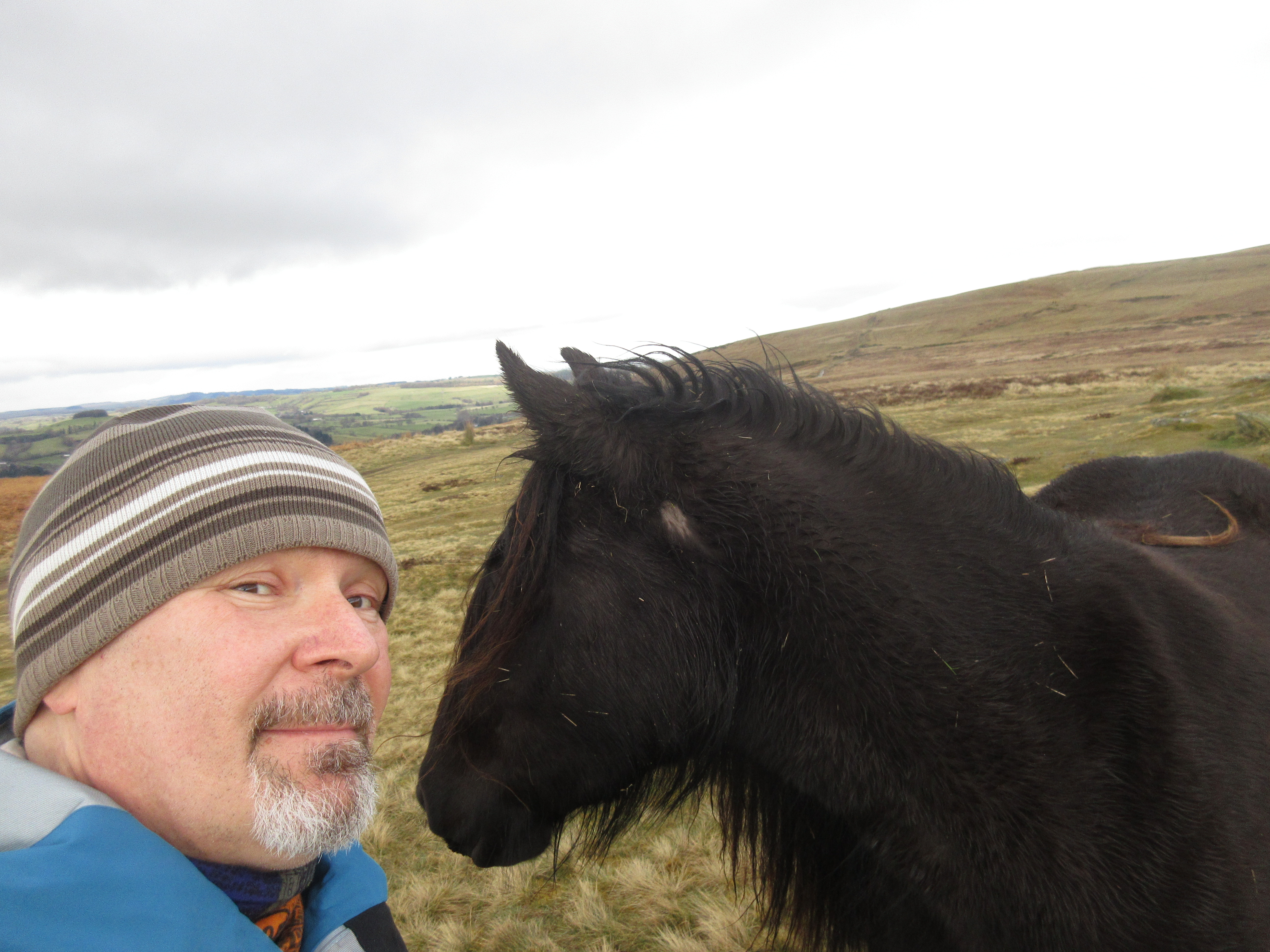
Beyond Howtown the path climbed gently up the side of Barton Fell.  The land flattened out as I ascended and gave wonderful views down Ullswater, twisting gorgeously away between grey and orange hills.  Up ahead I could see fell ponies and was surprised when a couple came over to see me at the Cockpit stone circle, even coming close enough for a pat and a stroke.  The group then led the way right up to Heughscar Hill, my planned destination (so that I could at least claim one summit, albeit an Outlying Fell).  Neither I nor the horse are very good at selfies.


From there it was an easy walk into Pooley Bridge but, with it being a shorter and easier day than I might have had, I was early, so I added an ascent of Dunmallard Hill (another Outlying Fell) to pass some time.  All that was left was a pint or two in the Sun Inn (bit pricey for Wainwright, I thought), the 508 bus to Penrith (bumping into a bloke from the hostel who had walked the north side of the lake, battling his way through the fallen trees), a couple of pints in the Fell Bar, a curry at the Raj, and a train back to Manchester.

Saturday, 9 December 2023

Some poems

Langdale


A transformation happens,
The lid is lifted from the world
And the land rises up.
Windermere, Wastwater, Derwent Water,
The whole reptilian glory of the fells,
Scafell Pike, Great Gable, Skiddaw,
Pike o’Stickle like a leviathan
Rising from the flood of Langdale.
The palm that cups Sprinkling Tarn
Raises us up onto Great End’s Band.
On this titled ridge
Our hands grip rocks.
Immy, the Mountain Gazelle,
Pushes her boots down on her apprehension.
‘You might call it “exciting”,’ she says before,
And adds afterwards, ‘I prefer it flat.’
Matt grips his own fear,
Finding distraction in others,
No pack on his back
Having served his time as Sherpa for the boys.
Great End, Esk Hause, Esk Pike
And then, like a gift, the summit of Bow Fell
Is all mine.
With an act of generosity, of grace,
The great unsettled stones
Convey me to the top,
Familiar ground blanketed beneath me
Under a sunny sky.
Evan empties Skittles into his mouth
And Erica finds another bottle of water
In her bottomless pack.
Dehydrated Coxy is dreaming of Primavera
But the only beat is the bassline
Of his pounding heart,
The only dancing his old man shuffle.
Another Band leads us down
To the Old Dungeon Ghyll.
Dave’s knees have gone.
I’m jogging.
As I walk back into camp I hear,
‘Hello Phil,’ from the twinned voices
Of Ailsa and Evelyn in the stream
And I float back on the warmth of that welcome.


The Obstacle
The obstacle is not in the way,
The ridge is not impassable,
The summit is not unreachable,
The snow is not an abyss.
My wilful steps take me onwards,
This path I have made for myself,
A ragged pattern of peaks and gullies
Tracing a line on the graph,
A line on the map, a distortion of hills.
My heart’s insistent motor whirs on.
‘Auscultation of the heart revealed
A soft murmur in the aortic area.’
It murmurs as I cross the ridge,
Climb the rake,
Pass the chockstone that is
Lodged in the artery of rock.
The obstacle is not in the way,
The obstacle is the way.


Shipshape

(Gunvor 1912)
Two tall mainmasts spearing the grey sky,
The topsails furled, drawing black crucifixes
Against the vanishing ocean.
The other sails are square and true,
Though shaded darkly –
Washing drying on a sooty day.
The fore-and-aft sails are perfect triangles of white
Tethering the mainsails to the prow.
A full rig that could drive the barque around the world,
Through storms round the Cape,
Through dark nights in Biscay,
Over mammoth graveyards in the German Sea.
A strong ship faring forwards strongly,
As if the ocean were endless
And sailing were just a matter of belief.
There is no ending if you keep on going
With a breathless wind to fill your sails.

Only an end has come,
The angle of the masts is all wrong,
They cant to one side
And the decks are awash
As wild white waves foam over them.
The ship is perfect but for the sea crushing it against the rocks.
It has heaved half up, stoved in.
The men who drove it forwards have all left.
Their perfect ship, holed below the waterline,
Drowned, wrecked, no more use in the world.
What seemed perfection was flawed all along
And in a moment, all that seemed endless is gone.

Grace works this way too,
Lives spared for the loss of something else –
Possibility, potential, calm sailing
Through untroubled seas.
A ship with a foetid cargo shattered against rocks.

Wednesday, 22 November 2023

In Memoriam: Jim Sanderson

I wanted to say a few words about what dad did for me, what he gave to me and how lucky I was to have had him for a dad.  As everyone will testify, he was good company, easy to chat to, a sympathetic listener.  He loved a terrible joke, something the three of us have picked up.  He was always there to support us, whatever we might have put him through – and I fear we put him through quite a bit.

He loved music and loved to sing, indeed would sing at the drop of a hat.  The Parish Hall Players in Elvington provided him an outlet for this.  I joined in for a while, in pantomimes and other shows, before stepping away.  Then one year they were putting on a performance of Calamity Jane, with him typecast as a character called ‘Curly’, and he asked if I could help bulk out the chorus.  I reluctantly agreed but as time went on my part started to build up, rather against my will.  My reluctance cleared showed through because, after one rehearsal, he took me aside and asked if I could deliver my lines with a bit less sarcasm.  Thankfully I was saved from public performance when my brother kindly gave me chickenpox.  So thanks for that, Mikey.

We did more laddish things too. We watched the motorbike racing at Oliver’s Mount at Scarborough and I remember seeing the legendary Barrie Sheen racing, with his back wheel skidding away from him round a hairpin bend as we stood on the outside.  Health and safety was less of a thing then.

We went to Church Fenton airshow a few times, watching classic aeroplanes like Vulcans, Nimrods and Harriers, and we were reminiscing about this the last time I spoke to him, how loud the jets were and how he particularly liked the Lightnings.  And they were particularly loud.

Being an engineer, he was into technology, like cameras, hifi and TVs.  One year he brought home a computer, a Sinclair ZX81, that he had borrowed off a work colleague.  I was fascinated by what it could do and soon became hooked.  We got a computer of our own and I gave up my dreams of being a fighter pilot for the more glamorous and romantic role of computer programmer, which has been my career ever since.

He introduced me to rugby too and we used to go to watch Hull Kingston Rovers at (the old) Craven Park with his dad, my grandad George.  I enjoyed myself and became a big Rovers fan.  One year we went to the Challenge Cup Final at Wembley, though sadly we lost.  Some years later he switched to watching rugby union, which he came to prefer.  In the end I switched codes too (to the horror of my cousins– sorry) and when I became a Sale Sharks fan, I took him to a few of our games, returning the favour from earlier.

He was one of the founding leaders of the Elvington Scout group and I joined up too, going camping and hiking around Yorkshire.  He taught me valuable lessons in map reading and navigation that I still use today.  We went to the Lake District with some of his work colleagues a few times, climbing bigger hills than you get in East Yorkshire, and that left me with an enduring love of the Lakes.  In later years we did a few walks together in the gentler hills of the Wolds, though he still set a cracking pace on the flat that had me scurrying to keep up.

It's a bit of a cliché that people live on in the people who are left behind but like all good clichés there’s an element of truth in it.  All these things that he gave to me and inspired in me, things I still do all the time, give me a way to remember him and always be grateful.